Sunny Friday in Philadelphia region, but the weekend ends with storms Sunday. Here's the weather forecast.

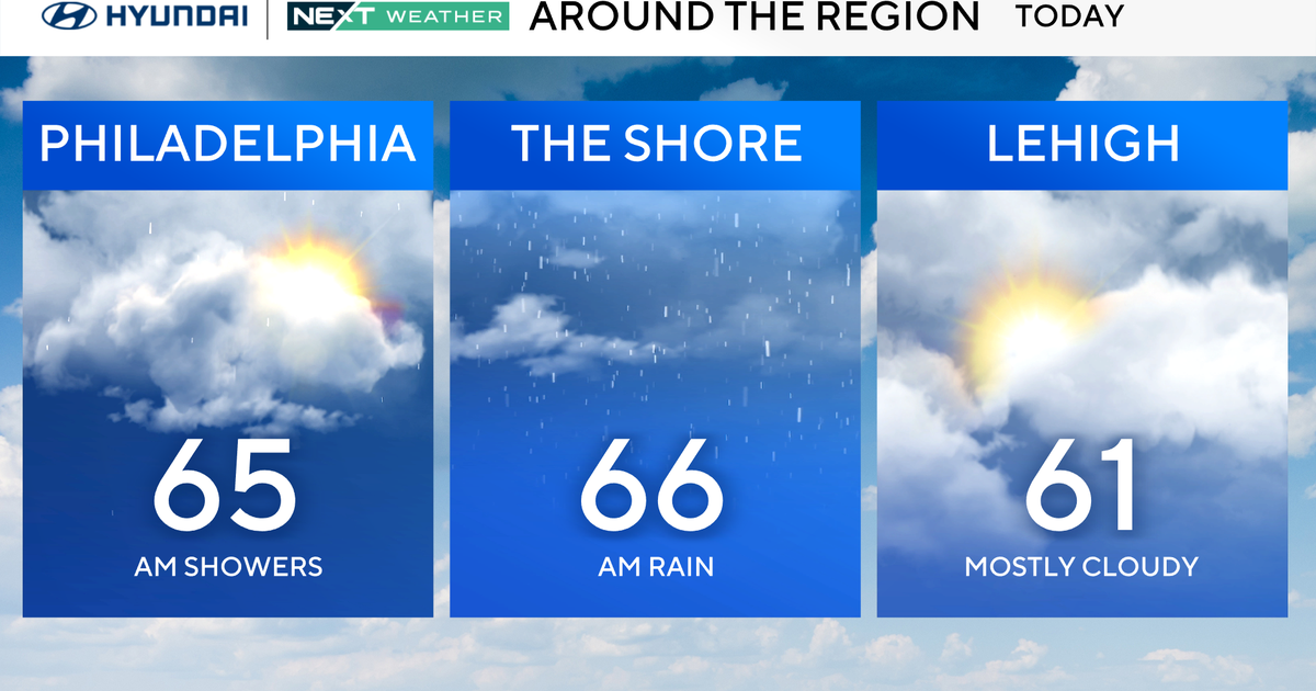
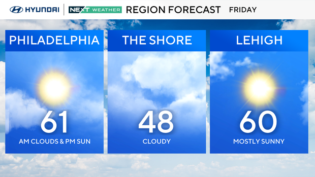
Welcome to Friday! Our week in the Philadelphia region ends with partly cloudy skies giving way to sunshine and highs again near 60, but we ARE tracking our next weather maker this weekend.
On Saturday, highs will be in the 60s courtesy of a warm front that lifts over the region, ushering in warmer air. Skies will be mostly cloudy with isolated afternoon showers.
That warm front is part of a huge and powerful storm that is making its way onto the West Coast on Friday. It stretches from Canada to Mexico and delivers heavy rain, severe storms, flooding and heavy mountain snow.
As the storm system crosses the nation between now and Sunday, there will be a trail of severe storms, including tornadoes, damaging winds and flooding.
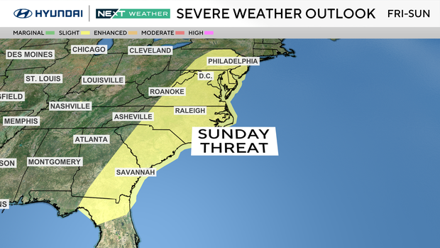
By Sunday, the East Coast will face severe weather.
The current timing for rain and storms includes scattered showers late morning through late afternoon, followed by heavy rain and strong to severe storms from late afternoon through late evening. Scattered showers will linger into the pre-dawn hours Monday morning.
The Storm Prediction Center has included Philadelphia in a risk of severe weather stretching from New York to Florida.
The threats include damaging winds, heavy rain and intense lightning. The storms could knock down trees and cause power outages, localized flooding, and travel delays by air, road and rail.
Sunday will also be breezy and warm, with highs on either side of 70 degrees.
Going to the St. Patrick's Day Parade? It will be mild and breezy near 70. It's best to carry an umbrella, though, for any isolated showers. However, the luck of the Irish is with us because the heaviest rain and storms are expected to hold off until after the parade.
On Monday, on the actual St. Patrick's Day, there is a chance of scattered showers pre-dawn, with clouds giving way to some sunshine. Temperatures will cool down to the 50s.
By next Wednesday, we are once again chasing 70 degrees.
Next Thursday is the vernal equinox, aka the official start to spring.
7-day forecast
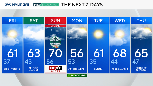
Friday: Brightening. High of 61, low of 37.
Saturday: A.m. fog, clouds. High of 63, low of 43.
Sunday: NEXT Weather Alert for storms. High 70, low 56.
Monday: Morning showers. High of 56, low of 53.
Tuesday: Sunny. High of 61, low 35.
Wednesday: Nice and warm. High 68, low 44.
Thursday: Shower chance. High of 65, low of 47.
Get the latest weather info on the CBS News Philadelphia app.