Rare risk of dangerous EF-2 tornadoes over Philadelphia Saturday evening. Here's the weather forecast.

Just as the wildfire smoke that blanketed the Philadelphia region the last few days begins to clear, severe storms now threaten the region Saturday afternoon through late evening.
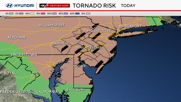
Any storm could turn severe today and many will. Storms will have a hatched 5% tornado risk (sounds low but in weather world it's big and hatched means strong tornadoes possible)
A tornado watch is in effect for the entire Philadelphia region until 9 p.m.
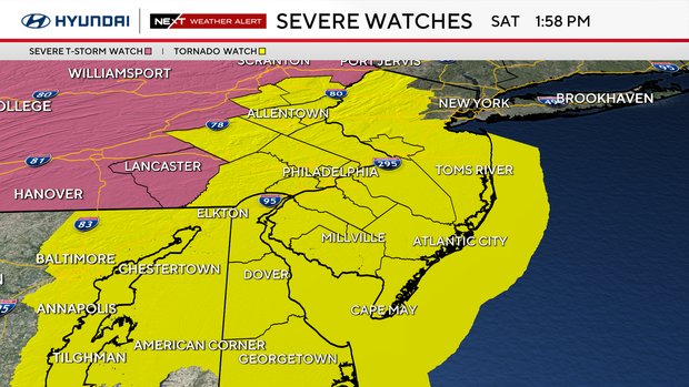
NEXT big change: EF-2 tornadoees threaten the region
Philadelphia is directly at the center of a widespread severe weather outbreak including damaging winds of 60-70 mph and the possibility of strong tornadoes up to EF-2 with winds of 111-135 mph. Several rounds of storms will pass the area with the greatest threat between 4 p.m. and 11 p.m.
These are possibly the most significant severe weather conditions since August of 2024.
The atmosphere is primed with warm, moist air in place. There will be plenty of lift and instability along with wind shear allowing storms to spin and produce tornadoes. A warm front has lifted north past the area with southerly winds that are pushing the wildfire smoke north of the area allowing sunshine to further fuel the storms.
Now we await storms to develop ahead of a powerful cold front and trough.
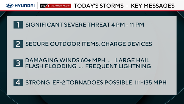
All these conditions have landed us under a rare level 3 of 5 risk for severe weather per the Storm Prediction Center. That level is issued when widespread severe storms are expected with life-altering severe weather threats likely. That has been the case in our past with numerous severe storm and tornado warnings being issued.
Even more rare for our area is a 5% risk for tornadoes. That may not sound impressive but in the world of weather it is extremely important.
Along with that 5% risk we are under a hatched area meaning strong EF-2 tornadoes are possible. These types of tornadoes are highly destructive and longer lasting.
We have only experienced a handful of EF-2 tornadoes in the greater Philadelphia area since the 1950's including November 1st, 2019, in Thornbury Township Delaware County and on September 1st, 2021, in Delaware County when the remnants of Hurricane Ida raced over the region and on July 29th, 2021, in Burlington County, New Jersey.
EF-2 tornadoes only occur in 8% of all tornadoes. Most of the tornadoes in Philadelphia history have been in the month of July.
Even more concerning today is the likelihood of damaging winds between 60 and 70 mph, intense and frequent lightning, hail over 1" in diameter and tropical downpours creating flash flooding.
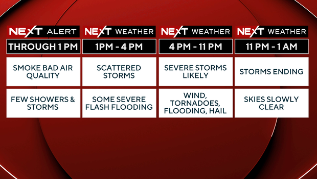
Timing storms
1 p.m. – 4 p.m.: We are in warm sector of storm ahead of cold front and there will be several rounds of storms, some of which could be supercells. Damaging winds, large hail, flash flooding, and an isolated tornado.
4 p.m. - 11 p.m.: This is the key time
- We are still in the warm sector and will interact with trough ahead of the approaching cold front.
- This is when the atmosphere will be most unstable and best suited for speed shear and spin for isolated supercell storms to possibly form.
- These are the ones that can produce strong tornadoes and microbursts.
- Flash flooding, hail larger than 1" and a high number of lightning strikes expected.
Staying safe during storms
- Charge your devices.
- Secure any items outside including trash that was not picked up due to the wildfire smoke.
- Clear any storm drains.
- Have a plan for you and your family. Know what to do and where to go before, during and after severe weather.
- Stay away from sinks, showers, and water sources during any storm due to the lightning risk.
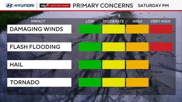
Possible impacts
- Trees down
- Power lines down
- Power outages
- Water rescues
- Roads flooded
- Air travel delays and cancellations
- Late day outdoor events moved-delayed-cancelled
Here's your 7-day forecast:
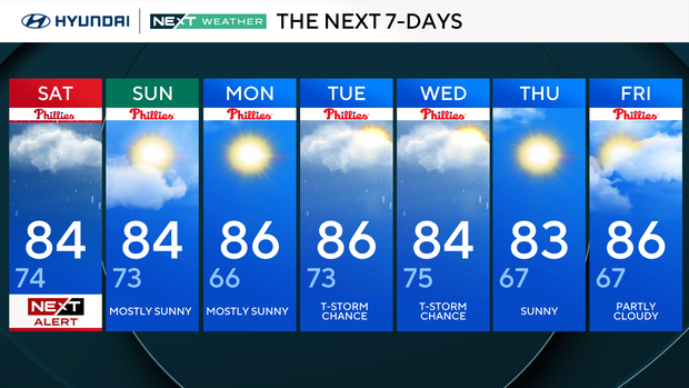
Saturday: NEXT Weather Alert. High 84, low 74.
Sunday: Mostly sunny. High 84, low 73.
Monday: Mostly sunny. High 86, low 66.
Tuesday: Thunderstorm chance. High 86, low 73.
Wednesday: Thunderstorm chance. High 84, low 75.
Thursday: Sunny. High 83, low 67.
Friday: Partly cloudy. High 86, low 67.


