High temps back in the 40s Monday in Philadelphia region, colder weather to follow this week

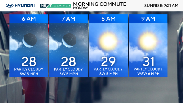
On Monday, the cold front will bump into a ridge of high pressure over the region and will be re-routed north around the ridge, leaving us dry with a mix of sun and clouds. That said, there may be a few stray flurries or sprinkles north and west of the city as the front passes in the afternoon. Highs will be above average in the low to mid-40s.
Behind that cold front, another push of cold air arrives, and by Tuesday it will feel like a rug-pull of the temperatures. Highs will drop below freezing between 28 and 31 degrees. Skies will be a mix of sun and clouds.
Wednesday and Thursday remain chilly in the 30s with sun and clouds each day. By Friday, the clouds clear and temperatures rebound to the low 40s.
MLK holiday weekend
We are tracking another storm next Saturday for the start of the long Martin Luther King Jr. holiday weekend. Highs Saturday will be in the 40s with rain possible late that day. Temperatures will start falling Saturday night, and there is a chance of the rain mixing with snow.

Sunday will be mostly cloudy and cooler in the upper 30s. On the holiday Monday highs will only be in the mid-30s under partly cloudy skies.
Here's your 7-day forecast:
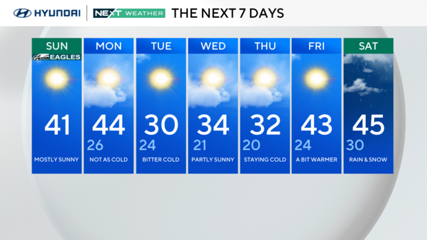
Monday: Partly cloudy. High 44, Low 27.
Tuesday: Bitter cold. High 30, Low 25.
Wednesday: Partly sunny. High 34, Low 21.
Thursday: Staying cold. High 32, Low 20.
Friday: A bit warmer. High 43, Low 26.
Saturday: Rain likely. High 46, Low 31.
Sunday: Rain clearing. High 42, Low 32.