Nor'easter set to hit Philadelphia area, Jersey Shore with heavy rain, strong winds. Here's the forecast.

The weekend is here, and while a nor'easter is approaching, it will not be a complete washout. That said, Saturday is your day to get some time in outside before weather conditions deteriorate into Sunday.
Saturday's weather is cloudy and dreary with some stray showers around the Philadelphia area. It will not be completely dry, with a few stray showers possible and a slightly higher likelihood in the Lehigh Valley through Saturday afternoon. Otherwise, conditions will be generally cloudy with high temperatures in the upper 60s to low 70s.
However, a weekend storm approaching the Jersey Shore later in the weekend is our top concern in this forecast. We've issued NEXT Weather Alert Days for Sunday and Monday as a coastal low moves north toward our region.
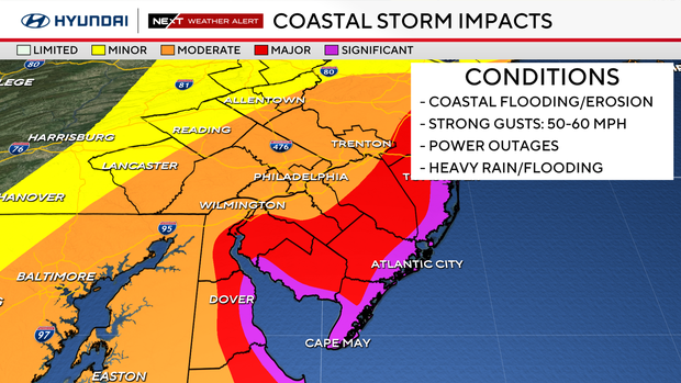
A coastal flood advisory is in effect from the city and a coastal flood alert for the Shore. Damaging winds of up to 50-60 mph could lead to power outages.
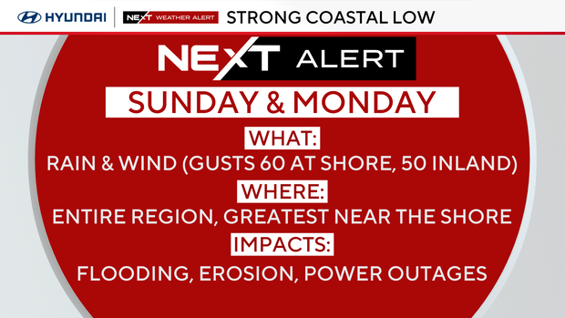
You should make backup plans if you have anything outdoors planned for Sunday, as this storm is predicted to affect most, if not all, of the Delaware Valley.
The coastal low-pressure system will start to take shape throughout the day Saturday off the southeast coast and begin to turn to the north into Saturday night. As the system approaches from the south, clouds will continue to thicken overnight, and the winds will also begin to increase out of the northeast.
By daybreak Sunday morning, winds along the Jersey shore will be around 20 mph with gusts approaching 30 mph. Inland, the winds will also increase to between 10 and 15 mph with gusts approaching 25 mph. The rain will also begin to spread over the region through midday Sunday, with the most widespread rain moving through the area Sunday afternoon into Sunday night.
Meanwhile, the winds will continue to increase along the coast with gusts approaching 60 mph on Sunday afternoon. Gusts inland won't be as strong, but still pretty high, near 30-40 mph. The strong and potentially damaging winds could produce power outages, especially along the coast, due to downed trees and power lines.
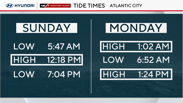
The persistent and strong northeasterly winds will also result in the potential for significant coastal flooding from the Jersey Shore into the Delaware Bay and Delaware River. Major flooding is expected along the coast at high tides, which will occur around midday Sunday, around 1 a.m., and a little after 1 p.m. Monday. High tide times will vary depending on location, but anyone near the water will need to remain aware of the quickly changing conditions Sunday through Monday and even into Tuesday.
You can see updated flooding projections and high tide times on a map at this website, water.noaa.gov.
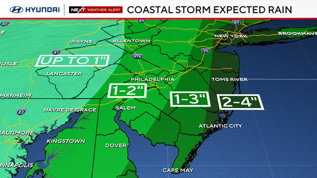
Heavy rainfall will also be possible because of this coastal storm, with 2-4 inches of rain possible closest to the coast, and between 1-2 inches of rain possible in the Philadelphia area. There may be some minor urban flooding in some poorly drained areas, but widespread flooding is not anticipated.
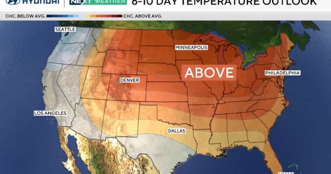
The storm system will begin to clear the region through Monday night, with a few lingering showers still possible into early Tuesday morning. The storm looks to gradually clear out through Tuesday, leading to a much calmer rest of the week.
Here's your 7-day forecast:

Saturday: Clouds, p.m. shower. High 72, Low 63
Sunday: NEXT Weather Alert for rain, high winds, coastal flooding, beach erosion. High 66, Low 63.
Monday: NEXT Weather Alert for rain, high winds, coastal flooding, beach erosion. High 62. Low 58.
Tuesday: A.m. shower. High 67, Low 56.
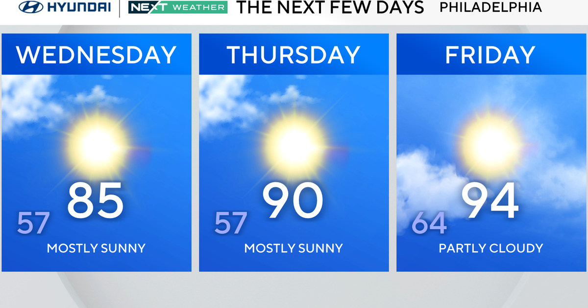
Wednesday: Mostly sunny. High 70, Low of 55.
Thursday: Cool. High 62, Low 48.
Friday: Mostly sunny. High 63, Low 51.