First Alert Weather: Red Alert in place Sunday for flash flood risk
The National Weather Service has issued a tornado watch for Nassau, Suffolk, Westchester and Putnam counties in New York until 3 p.m. Sunday.
A flood watch in effect all day for the Tri-State Area.
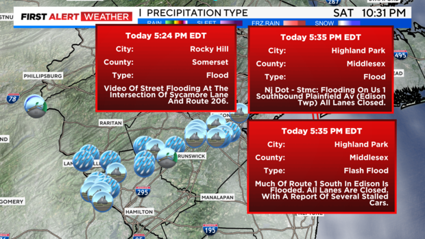
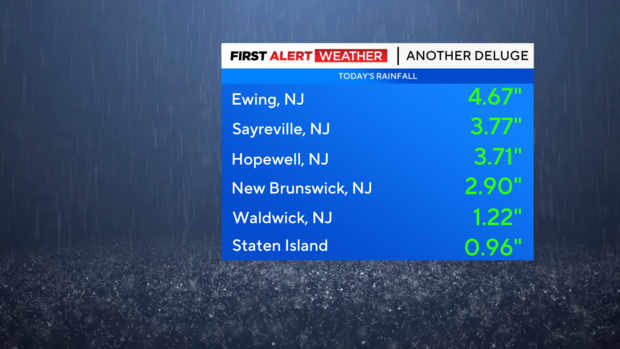
It was another hot and humid day Saturday. The steamy conditions yielded another active day for showers and storms across the region. Saturday, the majority of the activity was over New Jersey, where heavy rain resulted in numerous reports of flooding once again.
Saturday night, we'll see a brief break in the action before it ramps up again toward dawn. Our low will be a steamy 75.
Unfortunately, Sunday's atmospheric setup is looking very similar to last Sunday. Because of this, we have a Red Alert in place for the entire day, while a Flood Watch is also in place for the same timeframe.
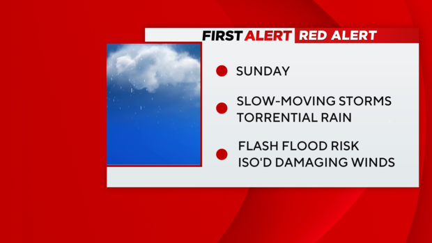
In what can be viewed as our version of an "Atmospheric River," copious amounts of moisture will flow into the area from the tropics, thus setting the stage for flooding rains to occur. Forecast models have struggled with the exact placement of the axis of the heaviest rain, but they do agree that a widespread heavy rain event is underway.
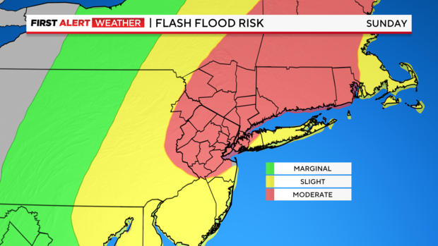
Average rainfall totals will be at least 1-2 inches, with totals of 3-5 inches very common, as well as isolated totals even higher. This comes on the heels of a week that has seen many communities devastated by flooding, and with the ground saturated in many places, it won't take much rain to cause more flooding.
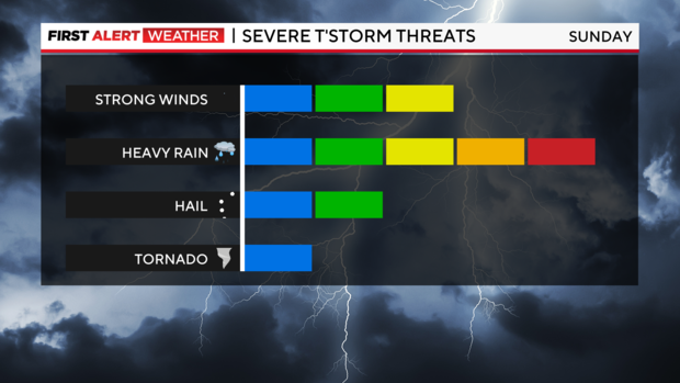
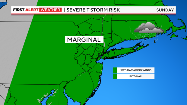
Although heavy rain is the greatest threat with Sunday's showers and storms, severe thunderstorms capable of producing damaging winds and hail are also possible.
It will be very muggy with a high of 82.


