Severe weather slows Memorial Day travel around NYC. Maps and live radar show the current conditions.
NEW YORK -- Thunderstorms and flash flood risks were in the forecast Monday around the Tri-State Area as people made their way home from Memorial Day weekend travel.
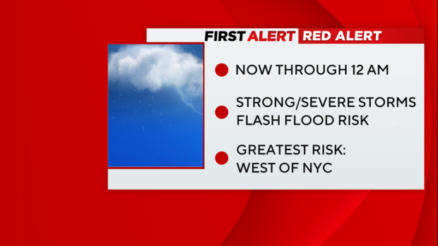
The CBS New York First Alert Weather team extended its Red Alert due to severe weather risks. Flood advisories were issued for Bergen, Essex, Orange, Passaic and Rockland counties late Monday night.
A severe thunderstorm watch for most of the area ended at 9 p.m.
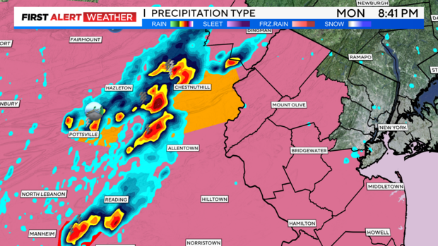
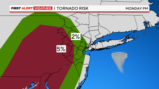
Strong storms in Pennsylvania prompted tornado warnings that could've reached New Jersey, but the storm lost some intensity once it reached our area.
Stay up to date with the latest forecast and live radar here.
Weather today calls for thunderstorms, possible tornado
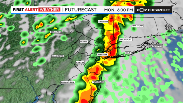
We saw a cloudy start to the day, along with some dense fog in spots along the coast. A few showers and thunderstorms continued to move through north/east of the city, with another batch in southern New Jersey.
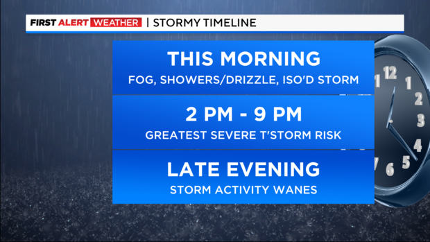
Meanwhile, clouds thinned out to the west, which only helped fuel the second round of storms for the afternoon. We had a bit of a lull until then, although a shower or storm was still possible at any time (we call that pre-frontal convection).
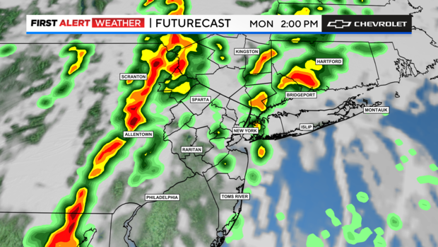
More storms fired up to our west in Pennsylvania after 1 p.m. or so. The window of concern shifted slightly earlier compared to over the weekend, from approximately 2 p.m. to 9 p.m. from west to east (2 p.m. western N.J., exiting the east end 9 p.m.).
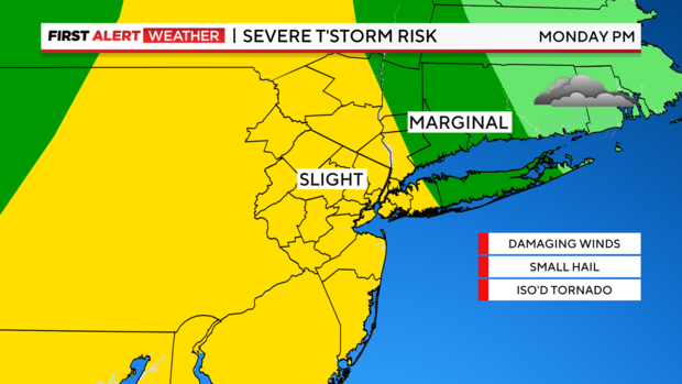
Main concerns are for heavy rain and damaging winds, but an isolated tornado cannot be ruled out.
Timeline for weather this week
Monday (Memorial Day): Mostly cloudy, showers and storms likely, especially into the afternoon and evening. Cooler, but humid. Highs in the 70s.

Monday night: Leftover showers and storms will exit the area by midnight, then it turns partly cloudy overnight. Lows in the 60s.
Tuesday: Much brighter day and warmer. Just a slim chance of an evening pop-up shower. Turns less humid. Highs in the low to mid 80s.
Wednesday: Sun and clouds. PM showers or storms possible. Highs in the mid to upper 70s.
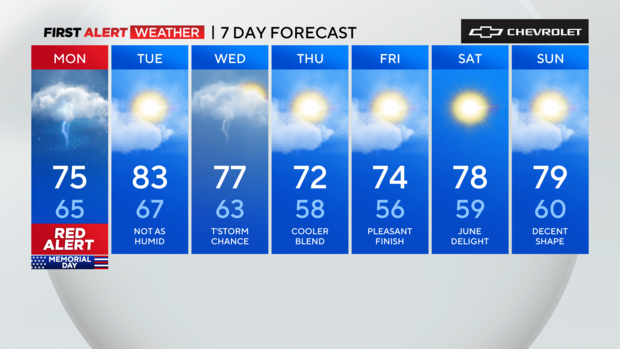
Thursday: Partly sunny, nice and comfortable. Highs in the low to mid 70s.
Friday: Pleasant finish to May as of now. Mix of sun and clouds. Highs in the mid 70s.


