Possibly Record-Setting Cold On The Way, Followed By Big Warm-up
MINNEAPOLIS (WCCO) -- Get ready for an intense blast of cold – but it won't last for long!
Flurries will start tapering off during Saturday morning, with accumulations in the metro done by 8 a.m. Additional accumulations in the metro will be about a half an inch.
Accumulations in southeastern Minnesota will be done by about noon, also up to about an inch.
Skies will start to clear up a little bit later Saturday, and we will have clear skies overnight -- which is when temperatures will start to plummet.
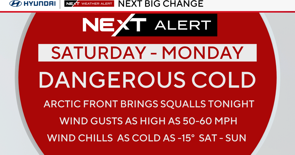
Wind chills during the day Saturday will be at about minus-15 degrees, and they will dip into the minus-20 to minus-40 range Saturday evening and overnight.
We will likely set a record low Saturday night of minus-25. The old record was minus-24, which was set in 1983.
Sunday's high will be minus-5 degrees, and wind chills during the day will still be about minus-20.
Monday, however, will be in the mid-20s and mostly sunny. Tuesday will be in the mid-to-upper-30s with a chance for some morning flurries.
We should stay at or above average for the rest of the work week, so hunker down and keep warm in the meantime!
For the latest, visit the WCCO Weather Center or download our weather app for your smartphone.