Highs reach into the 40s Friday in Twin Cities ahead of weekend cooldown, snow


Highs have returned to the 40s on Friday in the Twin Cities as winds have picked up, with gusts up to 30 mph.
Any snow showers on Friday will stay across far northern Minnesota, but some activity is expected farther south on Saturday.
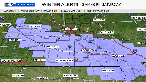
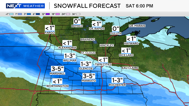
Winter weather advisories on Saturday have been expanded up from southern Minnesota to include the south metro. Around an inch is expected in the Twin Cities, with a sharp gradient in totals to the south. A swath between Interstate 90 and Interstate 94 should see 1 to 3 inches, but some isolated areas may see up to 5 inches. Expect travel issues in spots that see more activity.
The Twin Cities will cool back into the 20s both days this weekend.
The pattern looks quiet early next week, too, with temps slowly rebounding back into the 30s and 40s.