Dangerous cold all weekend in Twin Cities triggers NEXT Weather Alerts


Dangerous cold is the big story all weekend as the Twin Cities as temperatures are expected to plummet overnight Saturday.
Wind chills peaked near minus 20 degrees Saturday afternoon. Frostbite can set in on exposed skin in 25 to 30 minutes in these conditions.
An extreme cold warning is in effect for northwestern Minnesota until noon Saturday for wind chills near minus 40.
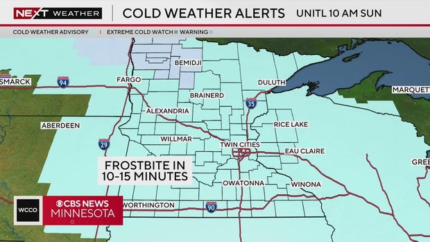
A cold weather advisory is in effect for all of Minnesota until 10 a.m. Sunday for wind chills between minus 25 to minus 35.
Temperatures barely made it above zero degrees on Saturday.
Clear skies on Saturday night allow temperatures to fall even further for Sunday, with morning wind chills as low as minus 30. In these conditions, frostbite can occur in just 10 to 15 minutes.

Temps climb above zero late as winds pick up out of the south, keeping wind chills in the teens below zero.
Eventually, temps rebound back into the upper 20s by Monday afternoon with some sunshine that carries over from the weekend.
Temps stay above average in the upper 30s mid-week with a slight chance for some rain/snow showers late Wednesday into Thursday.