NEXT Weather Alert for Sunday due to extreme heat; severe storms possible later in day

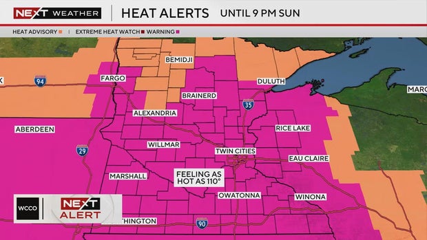
WCCO has issued a NEXT Weather Alert for Sunday for temperatures in the mid-90s and peak heat indices around 110 degrees.
The National Weather Service issued an extreme heat warning through 9 p.m. Sunday for much of Minnesota, including the Twin Cities metro. A heat advisory will be in effect through Monday.
There's a slight chance for severe thunderstorms from Sunday afternoon through Sunday night. Large hail and strong winds are the biggest concern. Storms are likely to develop across northern Minnesota and move southeast.
Monday will be dry and hot, though heat indices may not be as high as Sunday.
The rest of next week will feature temperatures in the low 90s and the next best chance for rain is Thursday.
Ways to stay cool
Hennepin County, Ramsey County and Dakota County all offer interactive maps highlighting places to cool off during the day. The maps include pools, malls, libraries and community centers.
Anoka County also offers a place to cool down. Their regular business hours can be found here.
Tips for homeowners
Xcel Energy has some advice to keep your energy bill in check:
- Use a programmable thermostat that adjusts based on when you're home
- Open interior doors to help cool air circulate
- Change the filter on your air conditioner and clean the coils
- Close your drapes and blinds during the heat of the day.