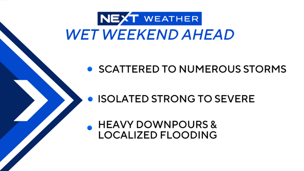
South Florida could see strong to severe thunderstorms this weekend that could lead to localized flooding

It's going to be a wet weekend across South Florida with scattered to numerous storms expected.
Passing showers and a few storms were also possible on Friday morning, but the rain chances were expected to be highest later on Friday afternoon and evening with more widespread storms likely.
Isolated strong to severe thunderstorms will be possible this weekend with the potential for heavy downpours, localized flooding and even some small hail.
It's been a mild start to the day on Friday, with temperatures in the low to mid-70s.
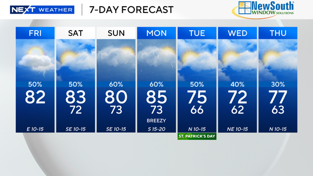
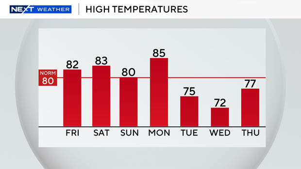
It won't be as hot on Friday due to the wet weather and more clouds, and high temperatures will be closer to normal in the low 80s.
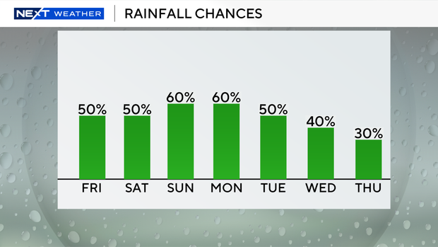
We will stay soggy and unsettled through Saturday and Sunday. There's a 60% chance of rain on Saturday and a 70% chance of rain on Sunday.
While some showers will be possible in the mornings, the worst weather is anticipated in the afternoons and evenings with the potential for widespread showers and storms.
Some of the storms could turn strong to severe.
High temperatures will stay in the low 80s.
And the rain chances will remain high through early next week with the potential for more rounds of wet weather through the middle of the week.
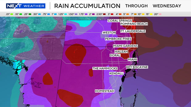
Through Wednesday, rainfall accumulations are forecast to reach 2-4 inches of rain with isolated higher amounts.
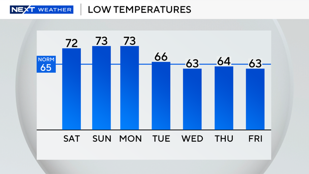
Early next week will be cooler. By Tuesday for St. Patrick's Day, we'll wake up with lows in the upper 60s, and highs will be pleasant in the mid-70s.
It will be even cooler by next Wednesday and Thursday morning with low temperatures falling into the low 60s and highs in the low 70s.