Warm temperatures expected in South Florida Wednesday afternoon cool start to day

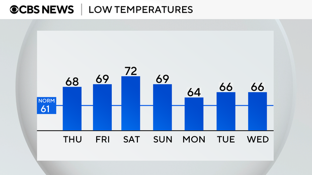
It's been another cool start across South Florida this Wednesday morning with low 60s inland and mid to upper 60s closer to the coast.
Some patchy dense fog has developed across the inland and western areas.
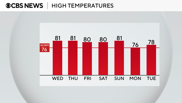
We will warm up this afternoon with highs in the low 80s under mostly sunny skies. A few isolated showers will be possible on Wednesday.
There is a low risk of rip currents along the Atlantic beaches today with a moderate UV index.
There are no alerts or advisories for boaters over the Atlantic waters or the Keys waters.
We will stay warm and mainly dry through late week courtesy of high pressure in control.
We'll enjoy cool mornings in the 60s and highs in the low 80s Thursday and Friday.
This weekend high temperatures will remain in the low 80s, but the chance of rain increases by Sunday due to our next cold front.
Spotty showers will be possible on Sunday into Monday.
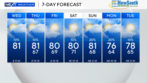
We'll enjoy a nice cool down by early next week, with highs in the low to mid 70s on Monday.
Highs will be pleasant on Tuesday in the upper 70s.