DFW Weather: Strong Storms Possible Sunday, More Forecasted Monday
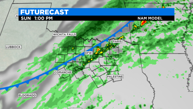
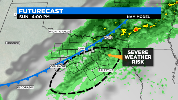
(CBSDFW.COM) - Rain and storms are in the forecast for Sunday. We have a cold front coming in mid-day for the DFW Metroplex. There is a risk of strong storms along and ahead of this front in the afternoon hours.

The first thing to know about Friday is that the temperatures peaked mid-day in the upper 60s. A cold front will push temperatures down into the mid-50s by the end of Sunday.
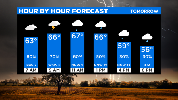
It is mostly just light rain in the morning for North Texas. As the front moves in, thunderstorms will start to develop by mid-morning.
The risk of severe weather includes 1" hail and damaging winds from these storms. The risk is higher for counties east and southeast of the DFW Metroplex.
Rain will continue once the front passes. Most of this will be light rain teamed with falling temperatures and strong northwest winds.

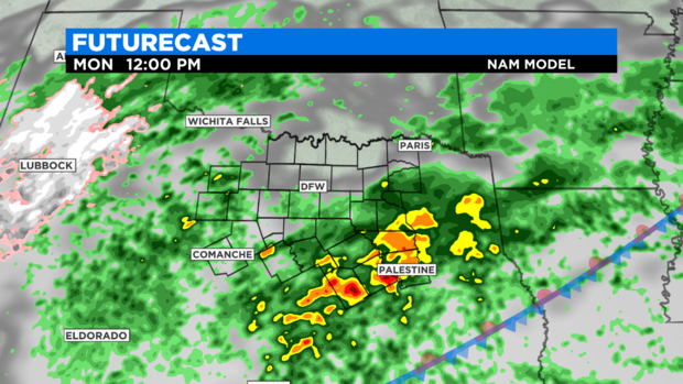
Rain and storms are right back in the forecast for Monday, March 1. The start of meteorological spring starts wet. Impressive rains could accumulate in our eastern and southeastern counties

By Tuesday we start to clear out. Rain is right back in the forecast for Thursday and Thursday night. That dry start to 2021 is over -- for at least this week.