DFW Weather: Flash Flood, Severe Weather Risks Continue In North Texas
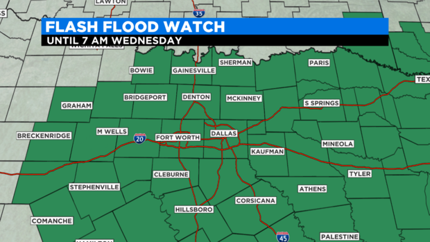
(CBSDFW.COM) - The flash flood watch continues until 7 p.m. Wednesday. Heavy rain hit some areas just west of the Metroplex in Parker and Palo Pinto counties this morning.
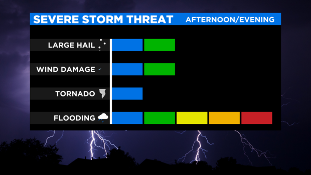
Flash flooding continues to be a major threat for North Texas. Damaging winds and large hail is also a threat. The storm outlook for the rest of the day includes a "slight" risk for a large part of North Texas.
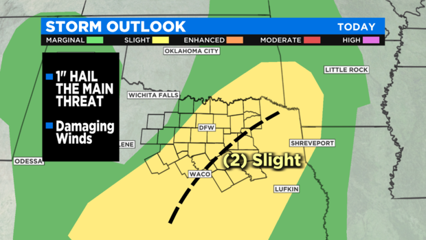
The higher risk of severe weather is in our southeast corner where temperatures got into the 80s.
Forecast models continue to show heavy amounts of rain possible for North Texas through Wednesday night.
We continue high chances of rain until the end of the week. The reason? Low pressure is stuck in place to our west while high pressure is building to our east.
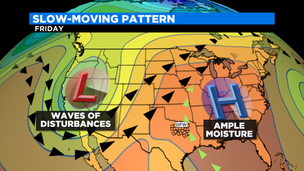
While the high pressure system continues to pump Gulf moisture into North Texas, the low to our west continues to send upper-air disturbances overhead. The hope is that by Sunday the rain chances for North Texas significantly drop off.
Get more forecast updates tonight at 4 p.m., 5 p.m., 6 p.m. and 10 p.m. with Scott Padgett and Erin Moran.