Stormy weather Tuesday, more on Wednesday, for Southeast Michigan


Severe weather returns to Southeast Michigan this week as a parade of fronts moves through the Great Lakes region.
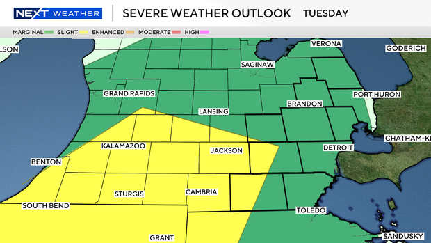
Storms on Tuesday are in the lower range of the severe weather risk scale, while those on Wednesday pose a higher risk.
Tuesday's forecast
Tuesday morning provided sunshine, but showers and a few storms are likely to pop in the afternoon.
The National Weather Service updated its forecast shortly before noon to indicate that part of Southeast Michigan is now in a "slight" area of severe weather risk on Tuesday.
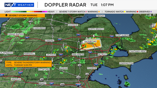
A severe thunderstorm warning was issued for Oakland County at 12:57 p.m. Tuesday and is expected to remain in effect until 2 p.m. for 60 mph winds and possibility of quarter-sized hail.
Wind and hail, along with some downpours, are the primary concerns for Tuesday afternoon and evening.
Wednesday's forecast
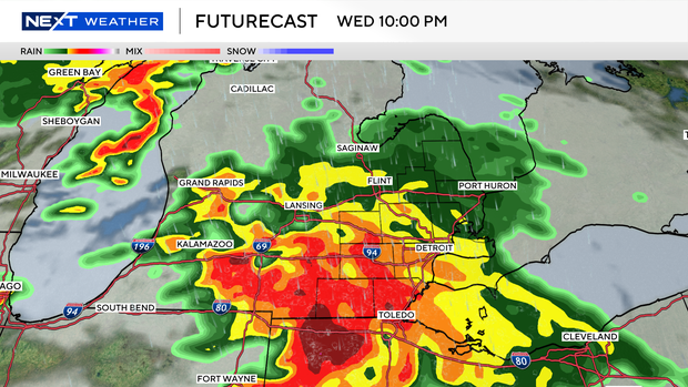
Wednesday is our main concern, but that is also much later in the day. The evening hours will bring a complex of storms into the area with strong winds and torrential rainfall as the main concerns.
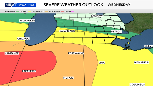
All hazards are technically on the table, primarily south of Interstate 96.
Because the storms are later in the day, our hope is for rainfall in the afternoon and evening to lower the concern as the sun sets.
We'll need to monitor this potential closely, as it poses severe risks. However, given the risks and the late hour, we're marking Wednesday as a NEXT Weather Alert Day. That means the CBS Detroit weather team will be stepping up forecasts and announcements as needed.
Make sure you have ways to receive alerts from Tuesday evening and into Wednesday night.
Stay informed
Stay with the NEXT Weather Team for updates. You can follow the reports on air, online, on our mobile app and on our social media accounts such as YouTube.