Southeast Michigan sees first wintry mix of the season. Here's where.

With our chilly morning rainfall, a few communities in Oakland County, Michigan, saw something even cooler: a few snowflakes mixed in with the rain.
This is nothing out of the ordinary, but it's a reminder that even in our strong El Niño-forecasted season ahead, snowfall will still happen.
For Friday morning, the wintry mix was easier to detect.
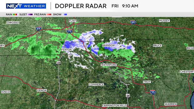
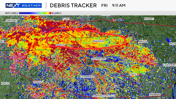
On radar, it looks like rain, but using a radar type called correlation coefficient, we can see the size and shape and tumbling of flakes look more like static than a solid red. If it were all red, it would mean more uniform shape and size, like raindrops.
Add the Michigan Department of Transportation cam to verify flakes on the lens, and away we go. Now, this doesn't mean we've reached our actual average date of snow, nor does this count as snowfall.
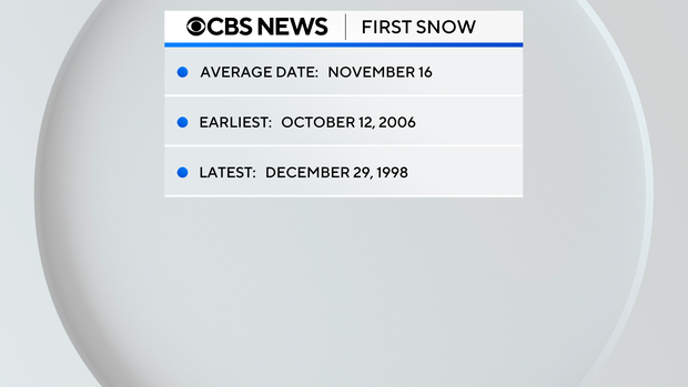
Our average first true snow, which would be 0.1 inches in some form, such as on grass or raised objects, is Nov.16. Admittedly, that's only 10 days from now.
The earliest date was Oct.12, 2006, and the latest first snow for us was Dec. 29, 1998. Rest assured, when the flakes do begin to fly this year, the NEXT Weather Team will have you covered.