More severe storms possible in Southeast Michigan Wednesday
As Michigan residents clean up from the Sunday storms, another low-pressure system is expected to move through bringing storms and another chance of severe weather Wednesday evening. We are considering Wednesday a NEXT Weather Alert Day.
Morning rain and snow has moved out, leaving a brief break in the system to some of Michigan's southern counties during the early and mid-afternoon. More showers and thunderstorms will move in late Wednesday afternoon and evening beginning just in time for the evening commute.
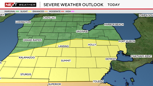
Southeast Michigan's severe weather risk outlet has decreased to a slight risk (2/5) of severe weather along and south of I-69.

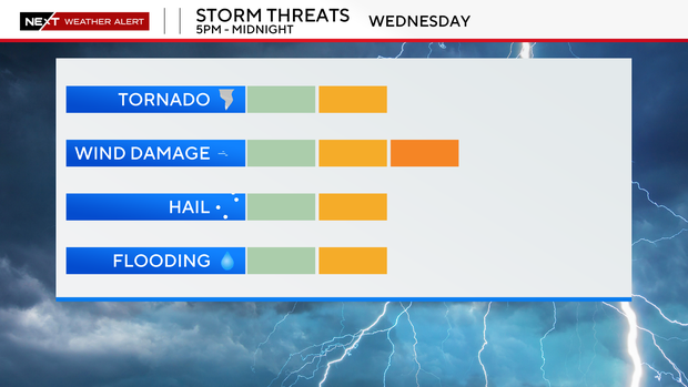
These storms will bring a chance for large hail, damaging winds, and isolated tornadoes. There will also be heavy rainfall, with up to one to two inches (possibly three inches locally) of rain by Thursday morning.
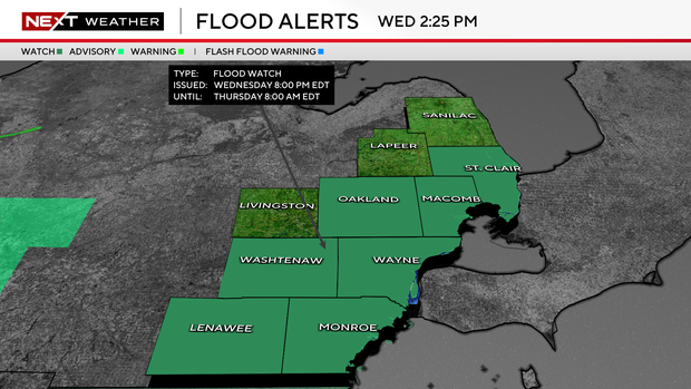
This heavy rainfall has triggered a Flood Watch for Lenawee, Macomb, Monroe, Oakland, St. Clair, Washtenaw, and Wayne Counties from 8 p.m. to 8 a.m. Thursday.
Your NEXT Weather Team will continue to monitor these storms. For the latest forecast, watch on air, online, or on the stream on PlutoTV.