High winds and storms expected to close out weekend in Southeast Michigan
A round of high wind develops Sunday afternoon as the warm sector of a low pressure system builds into lower Michigan.
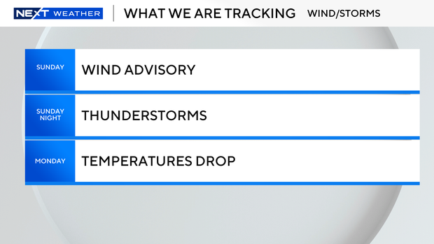
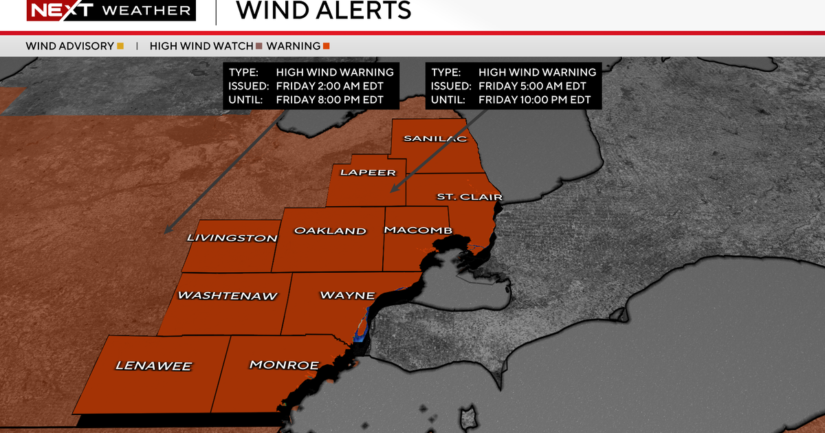
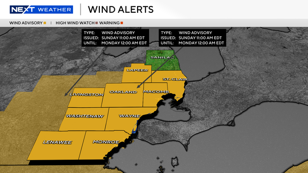
A wind advisory begins at 11 a.m. for the area along and south of Interstate 69, including metro Detroit down to the Ohio border. The advisory comes a day after high wind gusts blew through the region.
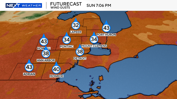
Surface wind gusts are expected to easily reach the 45 mph wind advisory threshold, especially by midafternoon and into the early evening on Sunday.
There is a good chance that the wind advisory will be expanded through Sunday night and Monday as a strong cold front sweeps across the region.
A line of showers and thunderstorms is expected to move through the area Sunday night, with some strong to severe storms possible.
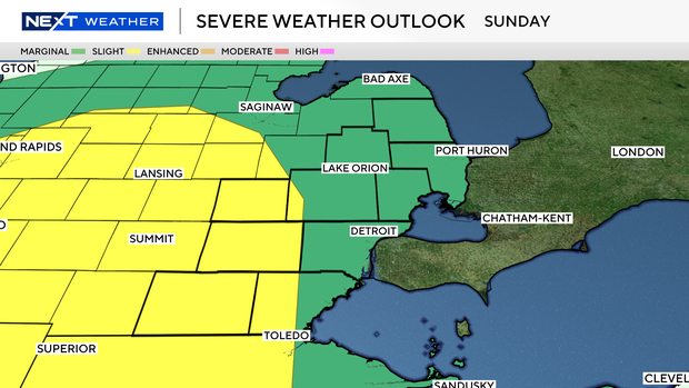
A marginal to slight risk is maintained due to the strong winds. Any storms will have the potential for damaging winds until the cold front sweeps eastward on Monday morning.
Monday will be windy, with gusts up to 45 mph possible. Snow showers are also possible as temperatures fall rapidly from the 50s in the early morning to the 20s by the evening.
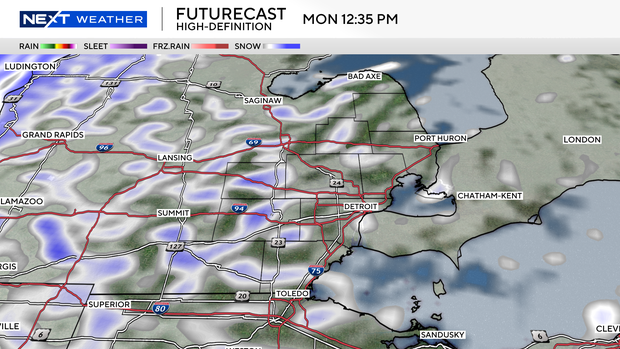
The inbound cold air and strong low pressure may result in lake effect snow showers or snow squalls between Monday afternoon and evening, with reduced visibility possible at times.
Temperatures will be in the 20s on St. Patrick's Day and warm to the 30s on Wednesday.
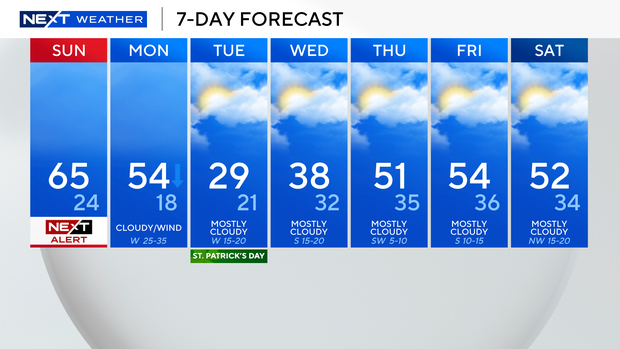
Thursday and Friday will be mostly cloudy in Southeast Michigan with high temperatures in the 50s.