Another round of snow and colder air this weekend in Southeast Michigan

A cold front will sweep through Southeast Michigan Friday afternoon and evening, bringing more snow, becoming briefly more intense before a dry slot arrives this evening and provides a transition into more scattered/lake effect snowfall. Gusty winds will contribute to blowing snow and reduced visibility.
Winds from the southwest will enhance lake effect snow overnight, with the best chance of additional accumulation (a dusting to an inch) along and north of the I-69 corridor.
Temperatures drop Saturday and Sunday with a few more chances for snow.
Slight chances for lake effect snow showers through the day Saturday, but again, winds from the southwest will favor accumulation north of Metro Detroit.
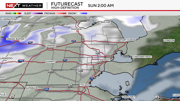
However, more snow arrives for the Metro Detroit area Saturday night into Sunday morning, with a half-inch to 1-inch accumulation likely.
The next wave in this pattern arrives Sunday night with widespread light accumulating snow falling into Monday morning, with blustery/squally conditions expected during the day Monday as arctic air surges in.
Looking ahead, expect frigid and blustery conditions Monday through Wednesday with wind chills near or below zero and additional snow showers. Dangerously cold wind chills near minus 15 degrees Fahrenheit will be possible on Tuesday morning.