Temperatures rise in Colorado under a clear sky on Friday

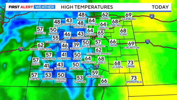
Temperatures will climb into the low to mid-60s on Friday under a mostly sunny sky.
While winds will be a little stronger throughout the day Friday, wind and warmth build heading into the weekend, as fire danger surges by Saturday.
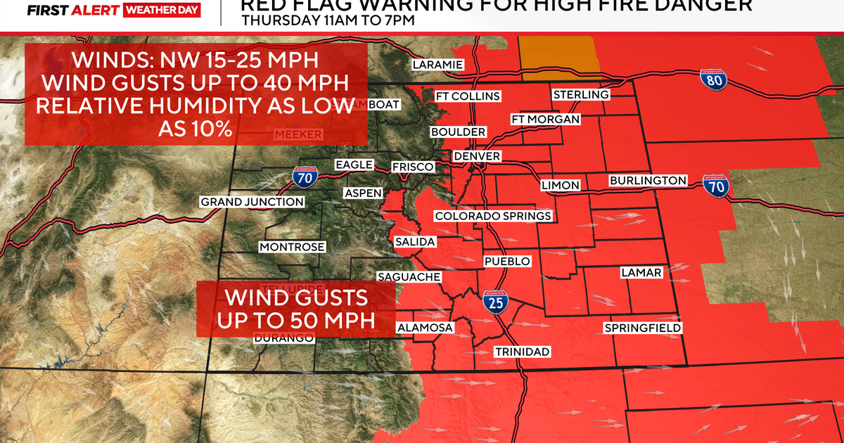
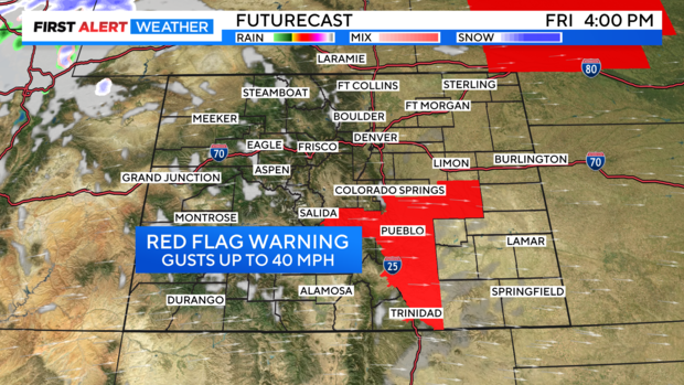
Fire concerns begin in Southern Colorado on Friday with Red Flag Warnings going into effect. Humidity will drop as low as 12%, as winds reach up to 35 MPH.
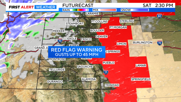
By Saturday, fire danger spreads North, as Red Flag warnings expand to include part of the Denver Metro and Northern Colorado. Along with very low relative humidities, winds could gust up to 45 mph as temperatures climb into the mid to upper 60s.
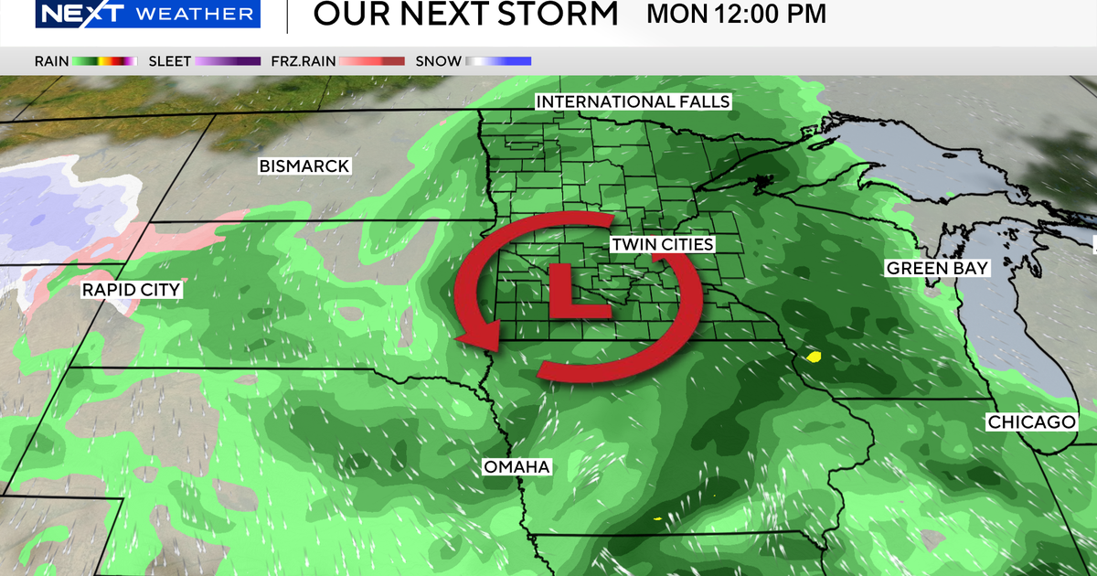
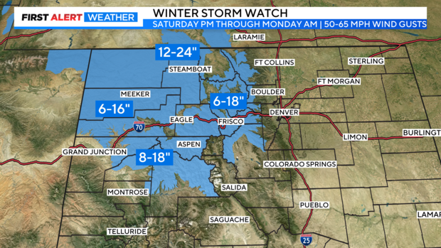
While fire danger increases Saturday for the metro and Plains, snow will begin to build into the high-country late Saturday. Winter Storm Watches go into effect Saturday evening for most of the central and Northern Mountains. Many areas can expect at least 8" of fresh snow, with as much as 2 ft possible into the Park Range through Monday morning. Along with the heavy snow, winds will be strong, gusting 50-65 mph, which will cause blowing snow, and visibility concerns.
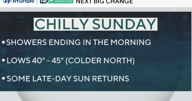
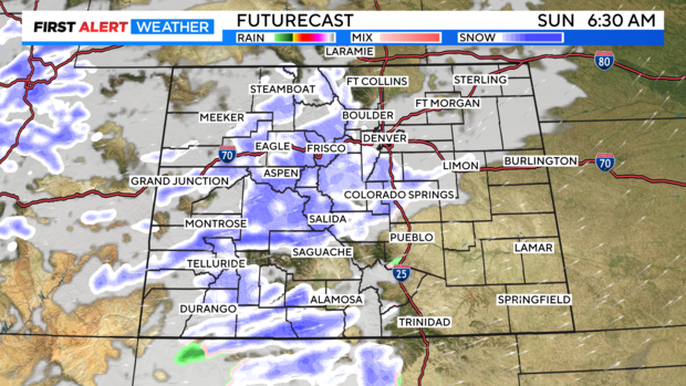
Some of that snow, mixed with rain will expand into the lower elevations by Sunday morning. While little accumulation is expected, it's possible to pick up some quick overnight accumulations as the snow does move in Saturday night into Sunday.
Snow and rain chances will linger into the start of the work week as temperatures dive into the upper 40s by Monday.