Strong winds and cold mix of rain & snow move into Colorado's Front Range and Denver metro area

A fast moving cold front and storm system are set to blast through the central Rockies Thursday night into Friday. A First Alert Weather Day has been posted for Friday as a result. There are Warnings and Advisories for heavy Colorado mountain snow and strong gusty winds across the state.
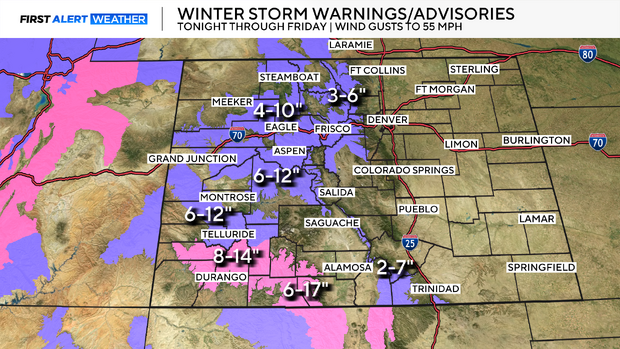
Lets start with mountain snow. There are Winter Storm Warnings for the southwestern areas and Winter Weather Advisories for the central and northern high country spots. Areas from Crested Butte and the Uncompahgre Plateau could see a foot of snow or more. Central and northern mountain regions could see 4 to 10 inches through Friday afternoon. Along with wind gusts of 50 to 55 mph during the period.
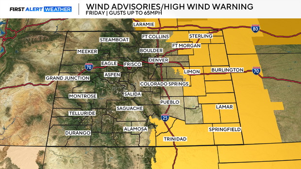
The extreme eastern plains have a High Wind Warning posted for Friday. Where wind gusts could get up to 65 mph during the day.
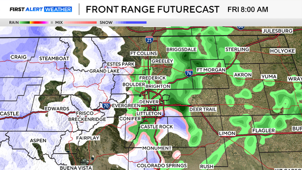
The storm system will have a minor impact on the Denver metro area where we are looking at a light mix of rain showers and light snow making for wet, slippery roads for the morning drive. There could be about 1/2 inch of snow accumulation in and near the foothills of Jefferson, Douglas and Elbert counties.
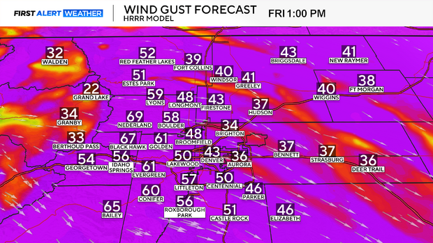
Wind will also be strong across Denver and the Front Range. Although there are no official warnings in place. The Denver metro area could see wind gusts up to 40 mph and areas in and near the foothills could see wind gusts up and over 50 mph at times.