Denver Weather: Historic Storm Brings Blizzard Conditions
DENVER (CBS4) - A powerful storm system heading for Colorado will bring rain, snow, and extremely fierce winds on Wednesday. We will start off with some rain late on Tuesday night in Denver, and that will quickly turn over to snow in the morning. This could mean another nasty commute to work, and the drive home won't be great either.
The storm is being called a "bomb cyclone" because the pressure in the center of the storm will drop fast as it races toward Colorado. It could be historic in terms of the minimum pressure ever measured in our region of the country. In other words, this storm is an aberration which is part of the reason we have a laundry list of weather watches, warnings, and advisories around the state.
RELATED: Flights Starting To Be Canceled Out Of DIA On Wednesday | Blizzard Warning Leads To Colorado School Closures | 'Bomb Cyclone' May Cause Migraines, Aches, Pains, Even Early Labor
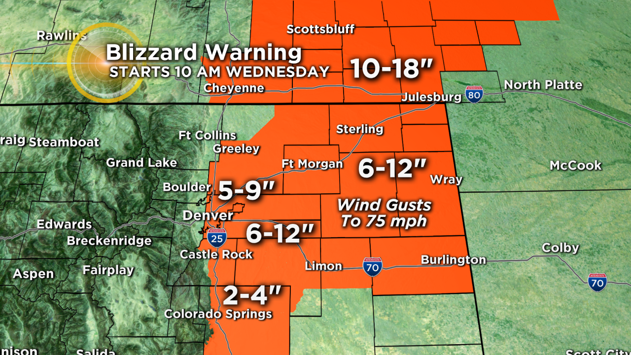
Almost everyone east of I-25 in Colorado is under a Blizzard Warning starting at 10am Wednesday. The warning includes the east half of the Denver metro area for at least 5 to 8 inches of heavy, wet snow and wind gusts to 60 mph causing near zero visibility. Farther east snow totals could reach a foot and will combine with wind gusts up to 75 mph causing travel to become impossible in many areas. The Colorado Springs area is also under a Blizzard Warning but snow total should be no higher than 4 inches.
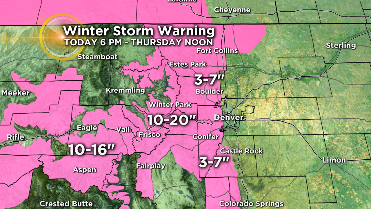
In the mountains, plan on winter driving conditions and possible road closures through Thursday morning with 10-20 inches of snow for the mountains of Summit County and the Winter Park area. Farther west amounts will range from 10 to 16 inches for the mountains west of Vail Pass.
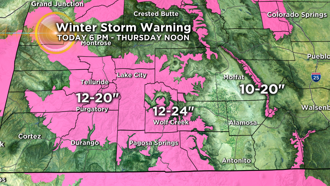
The San Juan Mountains in southwest Colorado will see at least another 12 to 24 inches of snow through Wednesday night. The Sangre de Cristo Mountains will see 10 to 20 inches and are under a Avalanche Warning through Thursday morning.
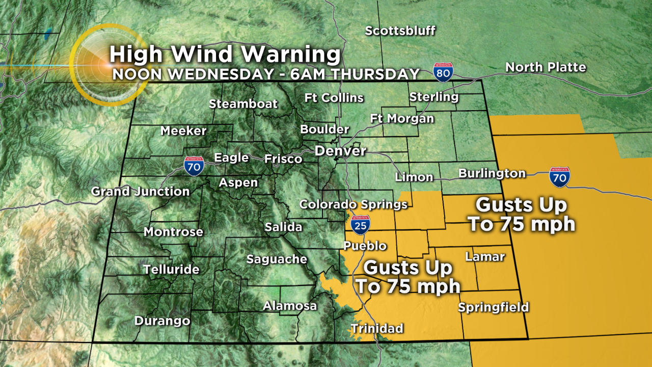
In southeast Colorado, most of the precipitation will be rain instead of snow. But these areas will be closest to the storm, wind will extremely fierce at times. Locations such as Lamar, La Junta, Burlington, and Springfield are under a High Wind Warning from noon Wednesday through 6 a.m. Thursday for gusts up to 75 mph.
Most of the snow will die down on Wednesday, late night. However, there will still be some light snow possible on Thursday morning. The snow will end by early Thursday morning leaving windy and cold weather for Thursday afternoon. We'll have another bitter night on Thursday into Friday. Somewhat warmer weather will arrive on Friday before a more significant warm up just in time for the St. Patrick's Day weekend.