Snow tapers off in Colorado but bitter cold settles in

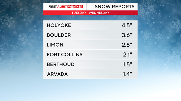
The snow has wrapped up, but now the bitter cold settles in. By Wednesday morning, most Denver metro neighborhoods ended up on the lighter side of snow totals, averaging 1-3" for most neighborhoods.
That light, fluffy snow caused slick and slow conditions throughout the morning commute, but the bitter cold will be the concern heading into the next 24 hours. High temperatures on Wednesday afternoon will only climb into the low teens, with wind chills throughout the day likely staying below zero. It will be much colder as we approach the early morning hours on Thursday.
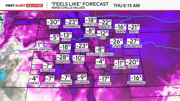
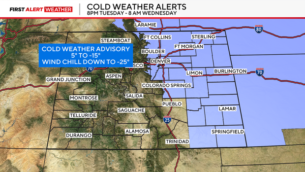
Across the Front Range and into the plains overnight lows will drop to the low single digits, if not below zero. Those cold air temperatures combined with the slightest breeze can take our wind chills down as low as -25 degrees. Cold Weather Advisories will be in place for the Denver metro area and adjacent plains through Thursday at 8 AM.
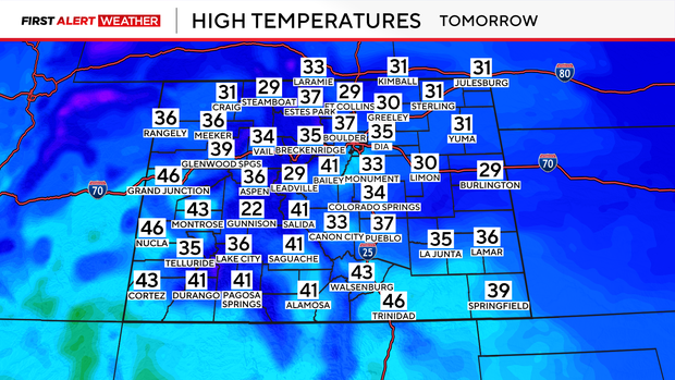
By Thursday afternoon temperatures will begin to climb out of the freezer. While most areas will stay below average, with highs only in the 30s, wind chill won't be as much of a concern by Thursday afternoon.
Heavy snow will then build back into the high country by Thursday afternoon, leading to a prolonged event for the mountains through the weekend. Some of Colorado's southern mountain areas could pick up as much as 2 feet of snow throughout the weekend.