Powerful winds bring back fire danger for Denver metro area, parts of Eastern Plains

Thursday is a First Alert Weather Day for the return of critical fire weather conditions across most of eastern Colorado including Denver and areas near the base of the Front Range foothills.
Coloradans from the foothills to the eastern plains and down into the San Luis Valley should brace for periods of intense wind over the next three days. Hurricane force winds are possible in some of our home states mountains during the day on Thursday.
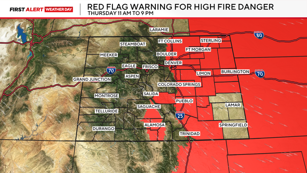
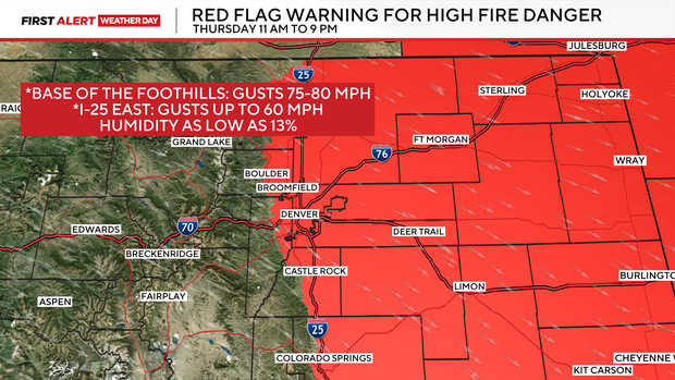
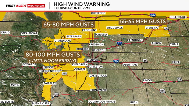
There is a Red Flag Warning in place from 11am to 9pm Thursday for areas at the base of the Front Range Foothills, the entire Denver metro area and most of the eastern plains. Wind gusts west of I-25 could gust 65 to 75 mph during the day. That with temperatures in the 70s and humidity levels as low as 13 % will create ideal conditions for rapidly spreading wildfires.
In addition to the Fire Warning, the higher mountain areas of the Front Range and mountain regions have a High Wind Warning for Thursday. Many of these areas may see wind gusts occasionally reach 80 to 100mph on Thursday. Strong winds are also possible on Friday and Saturday.
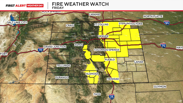
Fire Weather Watches have been issued for Friday, as more fire weather is expected. The watches are in place from 11 AM to 9 PM. Sustained winds of 30-40 mph are forecast, with gusts up to 70 mph for the Northern plains, and areas west of I-25. East of I-25 gusts could reach 50 mph.