Potential for severe weather grows in the afternoon and evening for Denver metro area, Eastern Plains

Colorado could be in for a rough round of severe thunderstorms Monday. A First Alert Weather Day is underway as the combination of heat, moisture and unstable air are expected to mix it up from Front Range out over the Eastern Plains well into Monday evening.
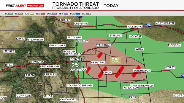
There's potential for large hail, damaging wind and possible tornadoes across the region including the Denver metro area and the northern I-25 urban corridor. A tornado watch is in effect until 9 p.m. for the Denver metro area and most of northeastern Colorado.
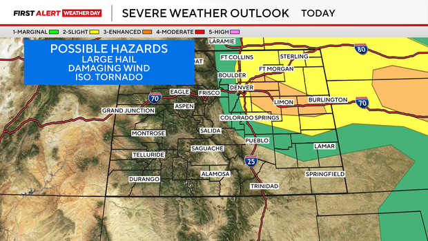
The Front Range and Denver Metro area has a marginal to slight chance for the severe triple threat. The greatest hazard will be large hail and damaging winds. The area in yellow and orange on the Severe Weather Outlook Map below may also see isolated tornadoes develop with possible rotation developing in the late day thunderstorms.
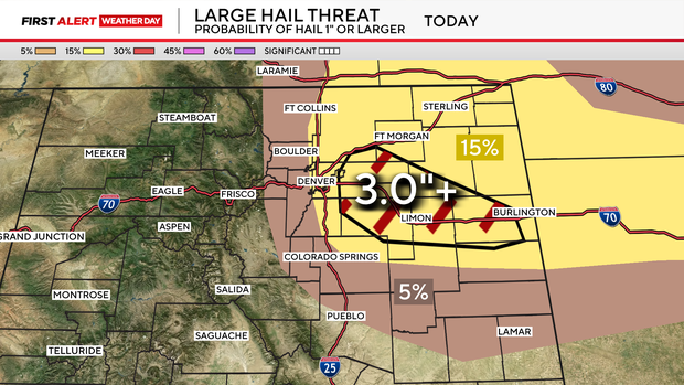
The Denver metro area may see quarter to half-dollar size hail this afternoon. The hatched area in the map below may see tennis to baseball size hail from east of DIA and Aurora out to Kansas and Nebraska.
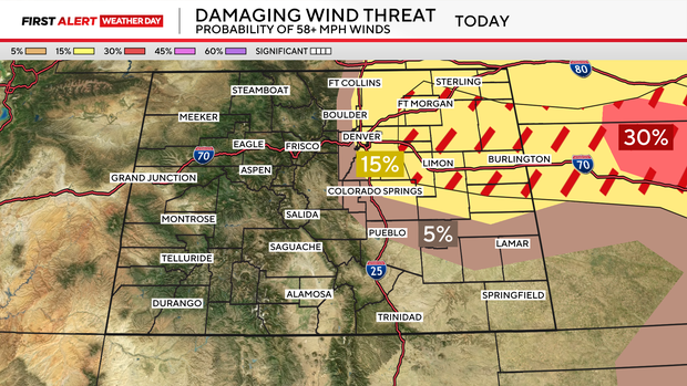
Damaging wind gusts are possible with Monday's round of thunderstorms. The potentential of 58 mph or stronger is definitely possible.
Any of our thunderstorms to start the week have the potential for tornadoes to develop. The lowest risk is in the green shaded are of the map below. With the greatest risk from Denver International Airport and Aurora spreading out over the Colorado plains to Burlington.