Temps climb into low 70s Monday before storm rolls into Colorado

Enjoy Monday as it's the calm before an incoming spring storm. High temperatures will climb into the low 70s across the Denver metro area with a chance of afternoon showers and a few thunderstorms. The real changes will arrive tonight.
A cold front pushes through Monday evening, and that's when things get going across the state. Mountain snow develops first, falling late tonight and continues through Wednesday.
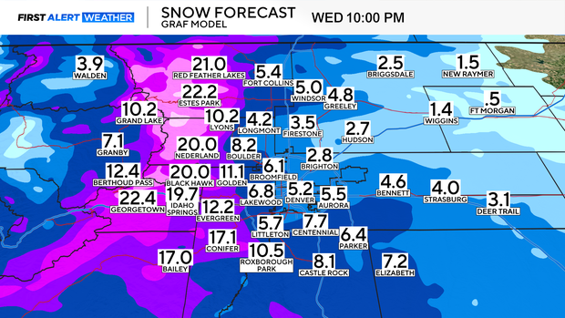
Tuesday starts with a rain/snow mix for Denver and the Front Range, with that heavy snow continuing in the high country. By Tuesday evening, colder air floods in, and rain flips to snow. The heaviest snow is expected overnight Tuesday into Wednesday morning.
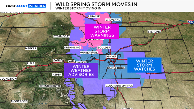
A Winter Storm Watch is in effect for the urban corridor with 3-9" of snow possible.
Several inches of heavy, wet snow are expected along the I-25 corridor, especially on grassy surfaces and cars. Roads could be slick during the Wednesday morning commute with the majority of the snow falling overnight Tuesday into Wednesday.
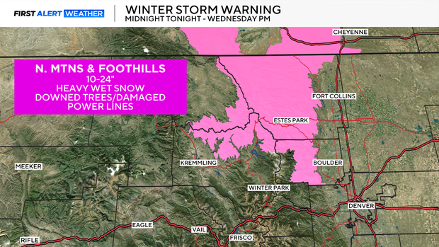
The Northern Mountains and foothills are under Winter Storm Warnings. Some higher elevations above 10,000 ft. could see up to two feet of heavy wet snow.
Travel in the mountains will be difficult to dangerous Tuesday night through Wednesday.
With heavy, wet snow fully leafed out trees could be at risk. Expect some downed branches and the possibility of scattered power outages for areas expecting higher accumulations.
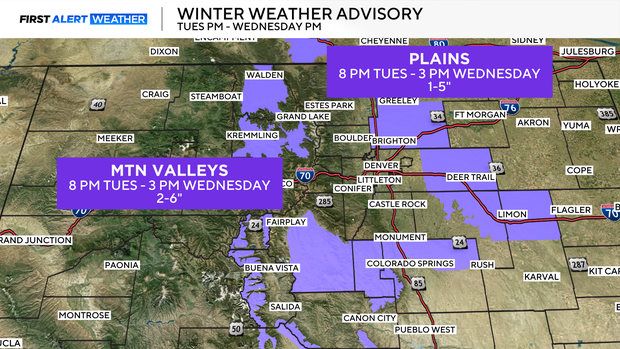
High mountain valleys are under Winter Weather Advisories, where 2-6" of snow is possible above 8500 ft.
For the plains, 1-5" of snow is possible.
Snow will gradually clear late Wednesday with much warmer temperatures expected on Thursday.
CBS Colorado's First Alert Meteorologists have called for First Alert Weather days both Tuesday and Wednesday this week.


