Heavy snow, strong winds set to create tough weekend travel across Colorado's mountains

A powerful winter storm is lining up to deliver heavy, wind-driven snow to Colorado's high country this weekend — potentially causing significant travel impacts along major mountain passes from Friday night through Saturday night.
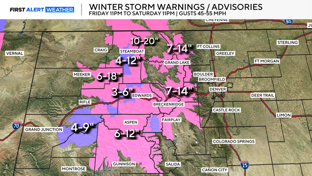
A Winter Storm Warning has been issued for several northern and central mountain zones, where the most intense conditions are expected along the I-70 corridor. Moderate to heavy snow throughout the day Saturday, coupled with strong winds gusting 50–60 mph across exposed ridges and passes. The combination will create dangerous conditions for drivers, including low visibility, drifting snow, and slick roads.

Accumulating snow will taper off late Saturday night, though some lingering impacts could extend into Sunday morning.
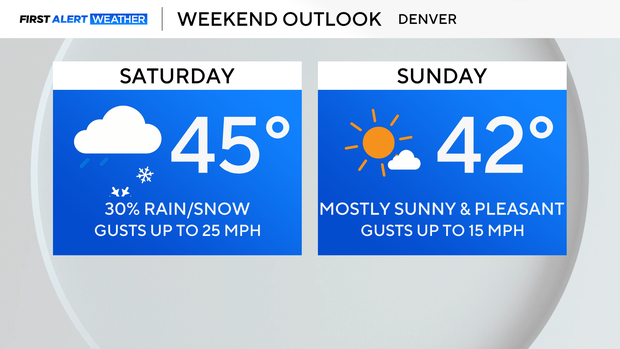
While the mountains contend with winter's full force, communities along the I-25 corridor will see a different story: generally dry weather and a gradual warming trend. Highs this weekend will reach the mid to upper 40s in Denver and the Front Range on Saturday, with slightly cooler temperatures on Sunday. A few isolated showers may pop up Saturday as the system swings through, but widespread precipitation is unlikely.