Denver Weather: Snow ends on Christmas Eve, plan on a colder than normal Christmas

After 1-2 inches of snow mainly on the grass Saturday night, the remainder of the holiday weekend will be mostly dry but cloudy and cold.
Denver officially received just a trace of snow as measured at the airport, but snowfall reports varied significantly which was expected with such a complex storm system.
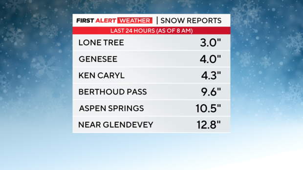
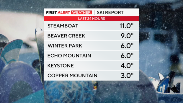
Some of the highest snow totals in the state were found on the far eastern plains near Kansas where heavy snow bands developed Saturday night. Many ski areas in Colorado also measured more than 6 inches of fresh powder just in time for Christmas.
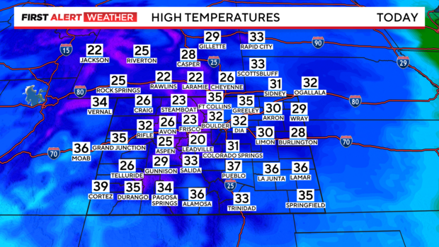
The big weather story on Sunday will shift from snow to cold with high temperatures staying below normal for Christmas Eve statewide. And Monday will likely be at least a few degrees colder in many areas for Christmas.
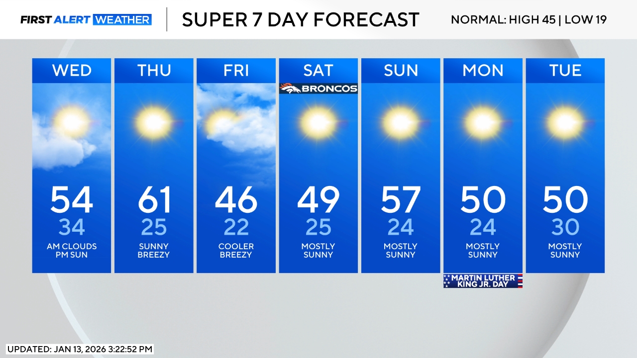
For the Broncos game Sunday evening at Mile High, expect temperatures in the 20s under mostly cloudy skies.
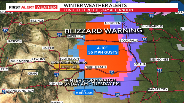
As the storm system moves east through the early part of the week, it will become a blizzard across much of Nebraska and blizzard conditions could impact a portion of far northeastern Colorado Monday night and Tuesday morning. For now, Blizzard Warnings are limited to Nebraska and part of South Dakota but they could be extended into areas like Julesburg, Colorado starting Monday night.
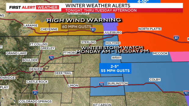
For Denver and the Front Range, nothing more than a few flurries are expected Monday night and Tuesday. The next chance for any measurable snowfall in the Denver metro area will be next weekend. At this time, the chance appears limited.