Denver Weather: First snow of the season possible early Thursday
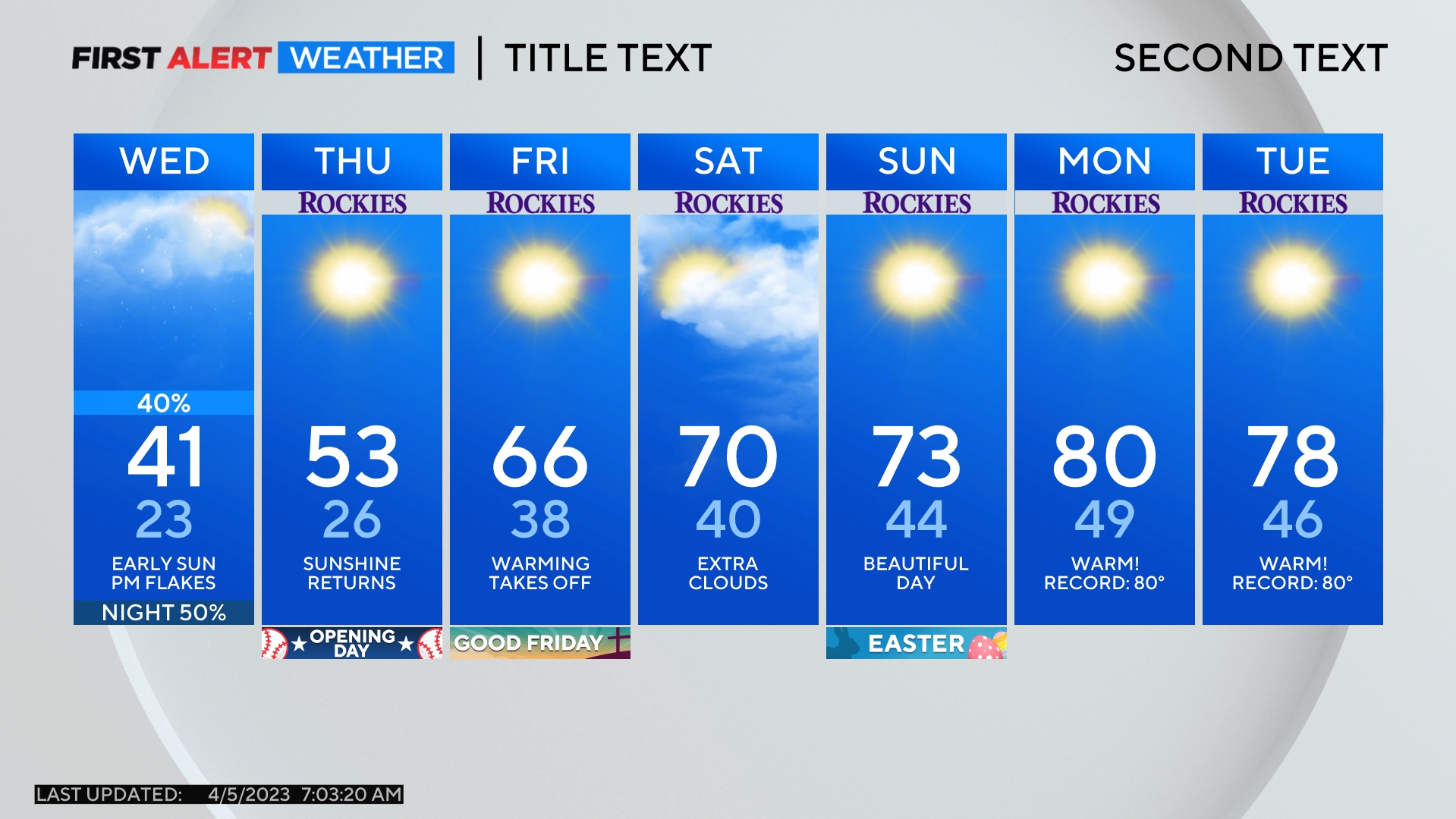
Just a few days after the first official freeze of the season on Monday, the first measurable snow of the season could arrive early Thursday.
A surge of snow in the mountains Wednesday morning will stop short of reaching Denver and the Front Range so the metro area will stay dry Wednesday. But a second surge of snow in the high country Wednesday night should successfully spread east to the urban corridor early Thursday morning.
The precipitation should start as rain around Denver, Boulder, and Fort Collins before changing into snow after 2 a.m.
CBS News Colorado has declared a First Alert Weather Day for Denver and the Front Range Wednesday night and Thursday due to the snow and the first hard of the freeze of the season expected Thursday night.
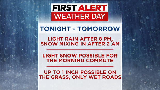
The best chance for snow in the Denver metro area will be between 3-6 a.m. Then a smaller chance will continue through about 12 p.m.
For most areas, no more than 1 inch of slushy snow will accumulate on grass, rooftops, vehicles. patio furniture, etc. Snow accumulation is not expected on roads below 6.000 feet. All roads in the immediate metro area should only be wet.
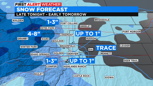
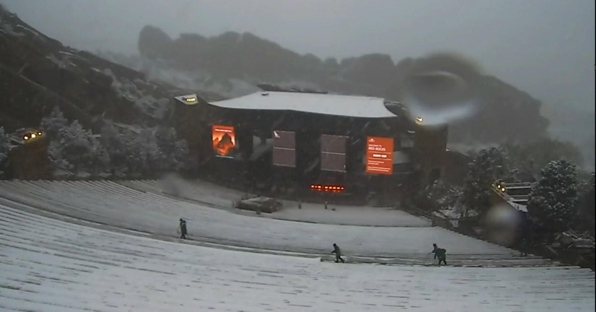
It's a different story in the higher foothills (above 7,000 feet) where up to 3 inches of snow could accumulate on Highway 285 above Morrison, I-70 above Genesee, Highway 36 above Lyons, and Highway 34 above Loveland.
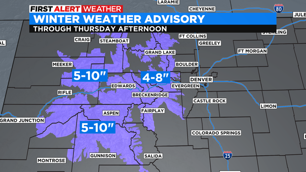
Meanwhile, most mountains in Colorado north of Highway 50 are under a Winter Weather Advisory through Thursday afternoon for up to 10 inches of snow. The advisory includes I-70 between Avon and Georgetown.
Snow will end statewide by late Thursday and attention will then shift to temperatures. Denver and the Front Range should experience the first hard freeze of the season early Friday morning. The forecast low in Denver is 28 degrees and many areas could be colder.