Denver Weather: Cold Front Arrives Bringing Blustery Conditions
DENVER (CBS4) - The latest winter storm to reach Colorado will cause snow in the mountains through the day on Tuesday. The snow will stop short of reaching Denver and the Front Range but not the wind.
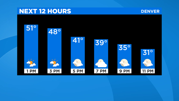
The cold front associated with the storm arrived on the I-25 corridor around 12 p.m. on Tuesday. Temperatures will gradually decrease behind the front as wind increases. Northwesterly winds will gust up to 45 mph in the afternoon. Before the front arrived, high temperatures along the urban corridor reached the 50s. Afternoon and evening temperatures will be in the 30s and 40s.
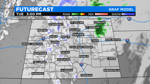
It's possible some light rain or snow could also reach the Eastern Plains (mainly east of Fort Morgan and Limon) Tuesday afternoon but no moisture expected around Denver, Boulder, or Fort Collins except for a few flurries or sprinkles in and near the foothills.
It's a different story in the mountains where 1-5 inches of total snowfall is expected by Tuesday night.
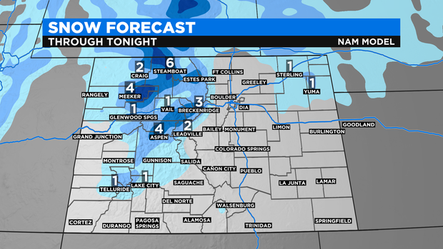
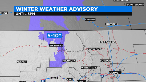
Higher totals are expected above 9,000 feet around Steamboat Springs including Rabbit Ears Pass. These areas could get up to 10 inches of light, fluffy snow.
The next cold front set to reach the metro area will arrive at the end of the week with colder weather in the forecast for Friday and Saturday. Snow is also possible along the Front Range on Saturday but there is a lot of uncertainty on accumulation. At this time it appears any accumulation would be limited to 2 inches or less. We'll continue to keep you posted!