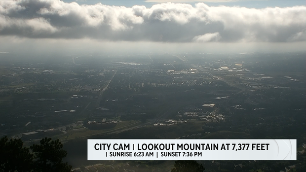
Denver fog and low clouds give way to late day storms
Happy Monday! We are starting the week with low clouds and fog produced from moisture and cooler air brought in with Sunday night's cold front.

Rainfall amounts on Sunday ranged from a half inch to over 1 inch of rain from two waves of thunderstorms pushing thru the Front Range and eastern plains.
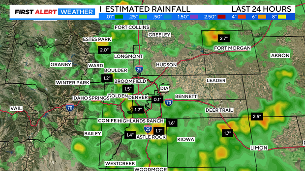
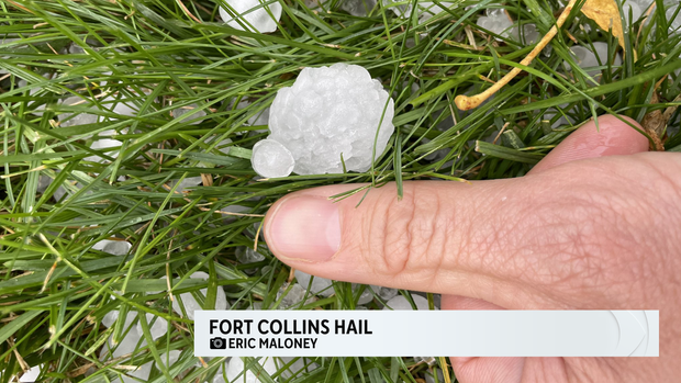
The early afternoon wave of thunderstorms dropped up to quarter size hail in the Fort Collins area. Eric Maloney took a pic with hail next to his thumb.
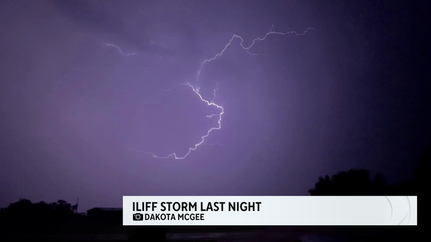
A second late night wave of storms fired up heavy rain and lighting from the Front Range to the far eastern plains. Weather Watcher Dakota McGee captured a spectacular lightning shot.
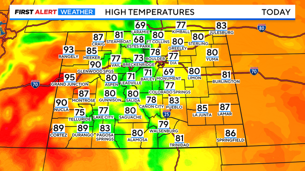
The low clouds and fog should thin out a bit by late morning. This will allow highs to rise into the 70s. Just enough to get thunderstorms building again by afternoon.

For the foothills storms may start to fire after noon with most of the Denver and urban corridor storms starting to push thru by 1pm or 2pm.

Some of the storms may have pockets of heavy rain during the afternoon drive and continue into the early evening off and on.


Temperatures across most of Colorado should be comfortably cool. With most temperatures in the 70s to near 80 for the eastern plains and mountains. Western Slope areas will still be hot with 80s to middle 90s expected.