Cooling system with rain, snow and Denver's first freeze
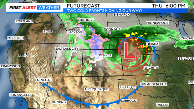
We are watching two cold fronts working there way toward Colorado. The first will slide thru tonight and the second on Wednesday. The second cold front will bring in strong winds, mountain snow and Denver rain along with it for the middle of the week.

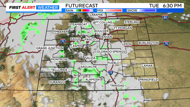
The weaker Tuesday night front will bring in a line of cloud cover over the Front Range and I-25 corridor Tuesday afternoon and evening. There may be a few very spotty sprinkles of rain with it.
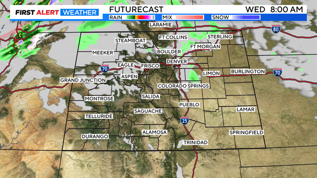
Low clouds will greet Denver and the Front Range on Wednesday morning behind the first cooler wave.
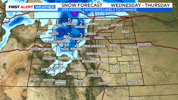
The stronger system pushes through as the day goes on Wednesday bringing in strong winds and afternoon showers and thunderstorms for the Front Range. Snow will develop in the mountains with several inches expected by Thursday morning. Thursday will also, bring measurable rain showers for Denver and the eastern plain.
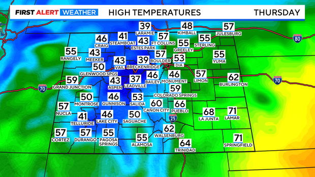
Temperatures will drop to below normal levels for both Thursday and Friday.
Some areas of the central and northern mountains may see 1 to 5 inches of snow. Driving could be a little slick over some of the higher mountain passes on Thursday.
The system will move out on Thursday night with clearing skies and colder temperatures. This may allow Denver to have its first freeze of the Fall season on either Friday morning or Saturday morning.
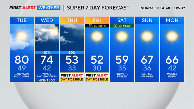
After the chilly morning on Saturday a slow warming trend begins again.