Colorado weather: Threat of severe storms this afternoon and evening

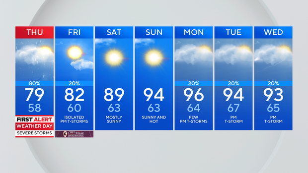
Afternoon and evening thunderstorms on Thursday will be capable of producing large hail, frequent lightning and heavy rain and the day has been declared a First Alert Weather Day. Scattered storms and showers are moving through the metro area and eastern plains this morning. We'll see the showers and storms move out later this morning and get a brief break before another round of storms and showers develops by early afternoon.
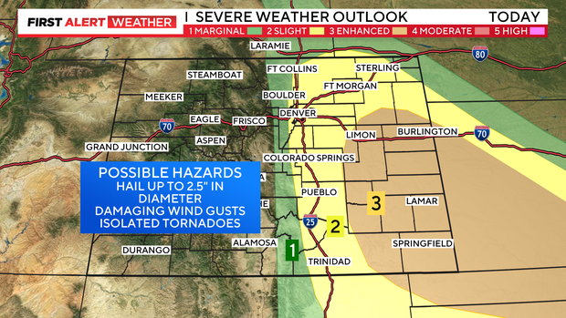
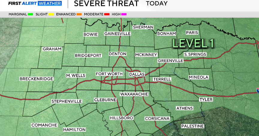
The storms will be capable of producing large hail, damaging winds, and even a tornado or two. Frequent lightning and heavy rain are also expected. The Denver metro area is under an "slight risk" of severe weather. That is level 2 on a 5 level scale. Portions of the eastern plains are under a "enhanced risk" and that is where we have the greatest threat of severe weather.
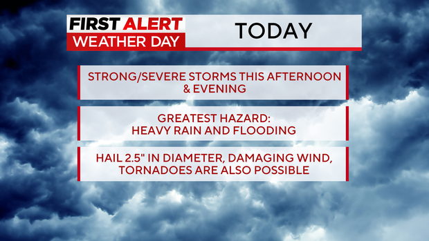
Due to the heavy rainfall that's expected a flood watch goes into effect this afternoon.

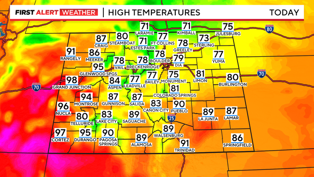
You'll also notice cooler temperatures today with highs in the upper 70s and low 80s in the Denver metro area. It will be nearly 10 degrees below normal for this time of year. Western Colorado will remain toasty with daytime high temperatures in the 90s.
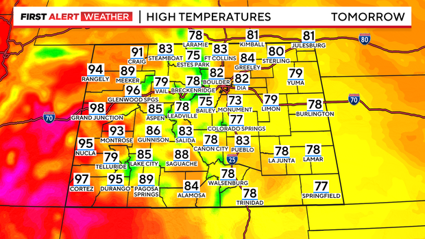
Tomorrow temperatures will still be below normal in the low 80s for the Front Range with only a few afternoon thunderstorms.
If you are heading to Cheyenne Frontier Days on Friday there is a 30 percent chance of showers and thunderstorms in the afternoon and early evening. Some storms could be strong to severe, with large hail being the primary threat.

Looking ahead to this weekend the weather will start feeling more summer-like with temperatures back in the upper 80s and 90s.