Colorado weather takes a sharp turn: Severe storms Saturday followed by mountain snow and a Monday chill

Strong to severe thunderstorms are possible Saturday afternoon before a colder storm system brings widespread rain, mountain snow and a major drop in temperatures by Monday.
Saturday will start relatively warm with temperatures remaining above average, but conditions will become more active through the afternoon and evening.
Scattered showers and thunderstorms are expected to develop, and a few storms could become severe, especially across northeastern plains.
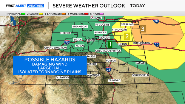
Some stronger storms may be capable of producing:
- Large hail, potentially around 2 inches in diameter
- Wind gusts up to 70 mph
- An isolated tornado
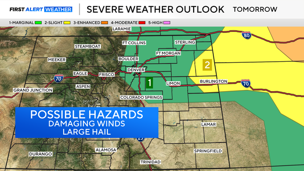
Another round of showers and thunderstorms is expected Sunday afternoon and evening.
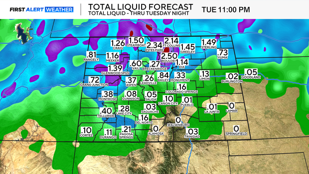
By late Sunday into Monday, precipitation becomes more widespread as the storm system moves across the state. Northern portions of the plains, especially along and north of Interstate 70 and Interstate 76, currently have the best chance of seeing heavier rainfall. Rain totals in those areas could range from one-half inch to more than an inch.
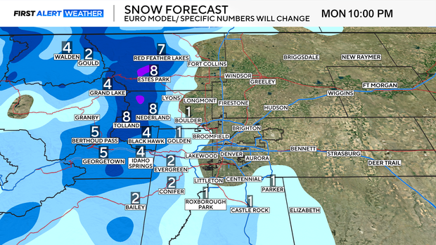
At the same time, much colder air arrives. The mountains could see between 4 and 10 inches of snowfall. For Denver and communities along the Interstate 25 corridor, snow accumulation chances remain low, though a few flakes could mix in Monday.
Temperatures Monday will feel much more like late winter than late spring with daytime highs in the 40s. The cold air could also set the stage for one final spring freeze Monday night.
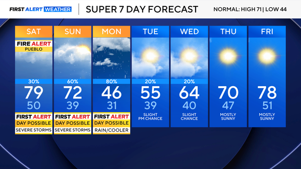
Conditions begin improving Tuesday, though temperatures are expected to stay below average before gradually warming through the week. High temperatures are projected to return to the mid-70s across the plains by Friday.