Colorado Weather Alert: Monsoon Storms Pose Flash Flood Threat Again Wednesday
DENVER (CBS4) - A plume of deep monsoon moisture will be over Colorado on Wednesday and that means we'll see a threat for slow-moving afternoon thunderstorms with locally heavy rain during the afternoon and evening. Over the past few days most of the rain has stayed in the mountains, but on Wednesday a few of the storms will move into the Interstate 25 urban corridor between Castle Rock and Fort Collins, as well as onto the adjacent plains.
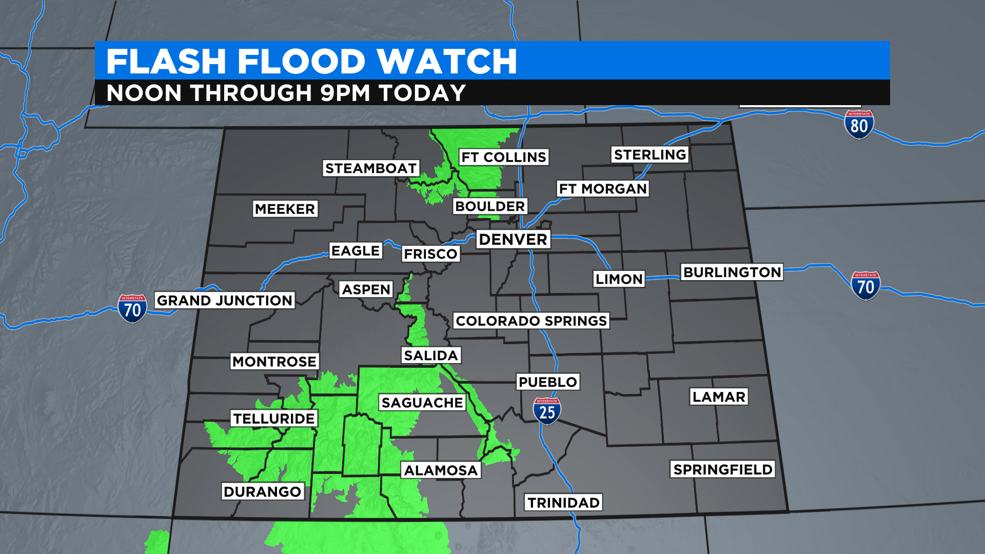
The National Weather Service has issued several Flash Flood Watches in Colorado Monday. They include all recent burns scars in the San Juan Mountains, Wet Mountains, Sangre de Cristo Mountains and the Front Range Mountains. But don't let your guard down just because your locations isn't in a watch area. We saw dangerous flash flooding a few weeks ago in Greeley when a slow-moving afternoon storm dropped 3 inches of rain in about an hour.
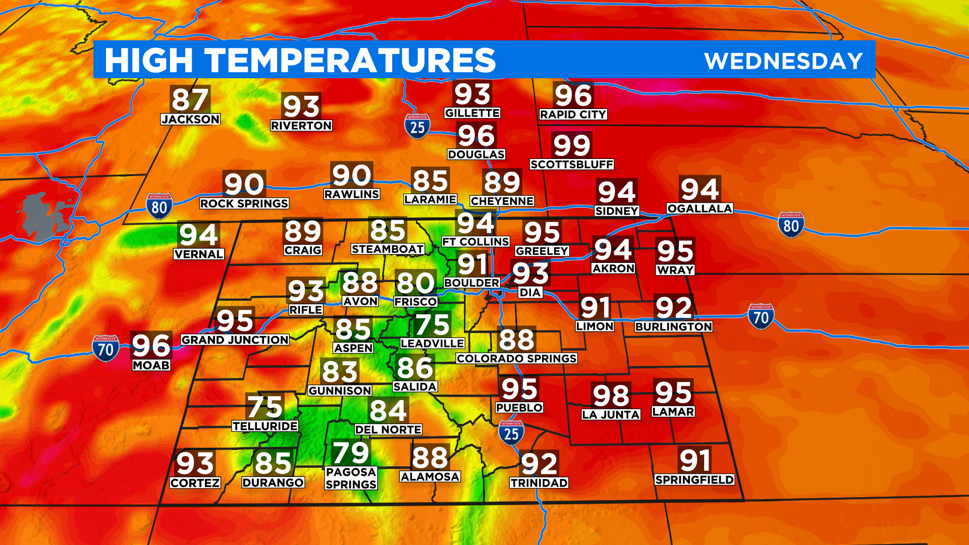
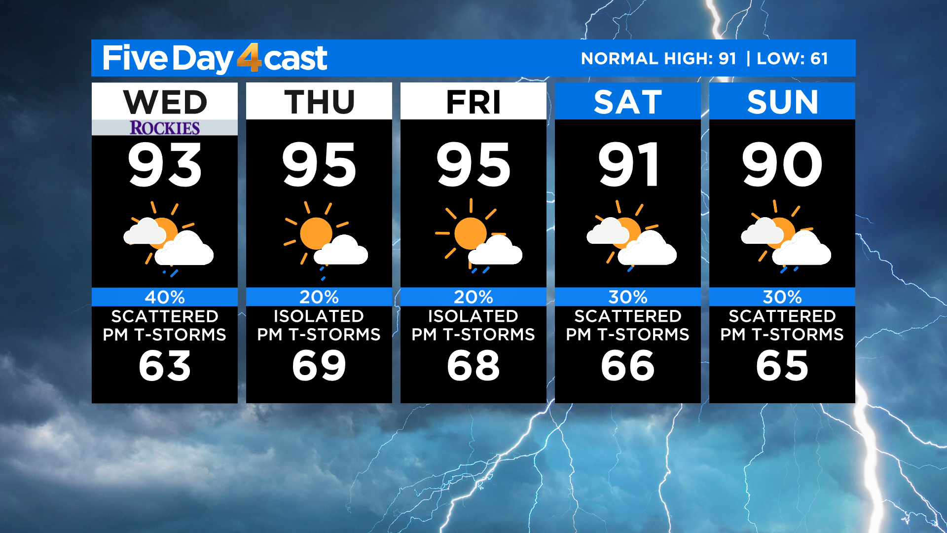
Temperatures will be at or slightly above normal around the state today with 80s in the mountains and 90s on the eastern plains and western slope. Denver's normal high is around 91 degrees this time of year.
RELATED: 1 Dead After Destructive Cache la Poudre River Flash Flooding In Northern Colorado
It's more of the same for the next several days with hot weather and scattered afternoon storms. We'll continue to monitor conditions for the flash flood threat in the days ahead.