Colorado Weather: A toasty Tuesday before t-storms come back
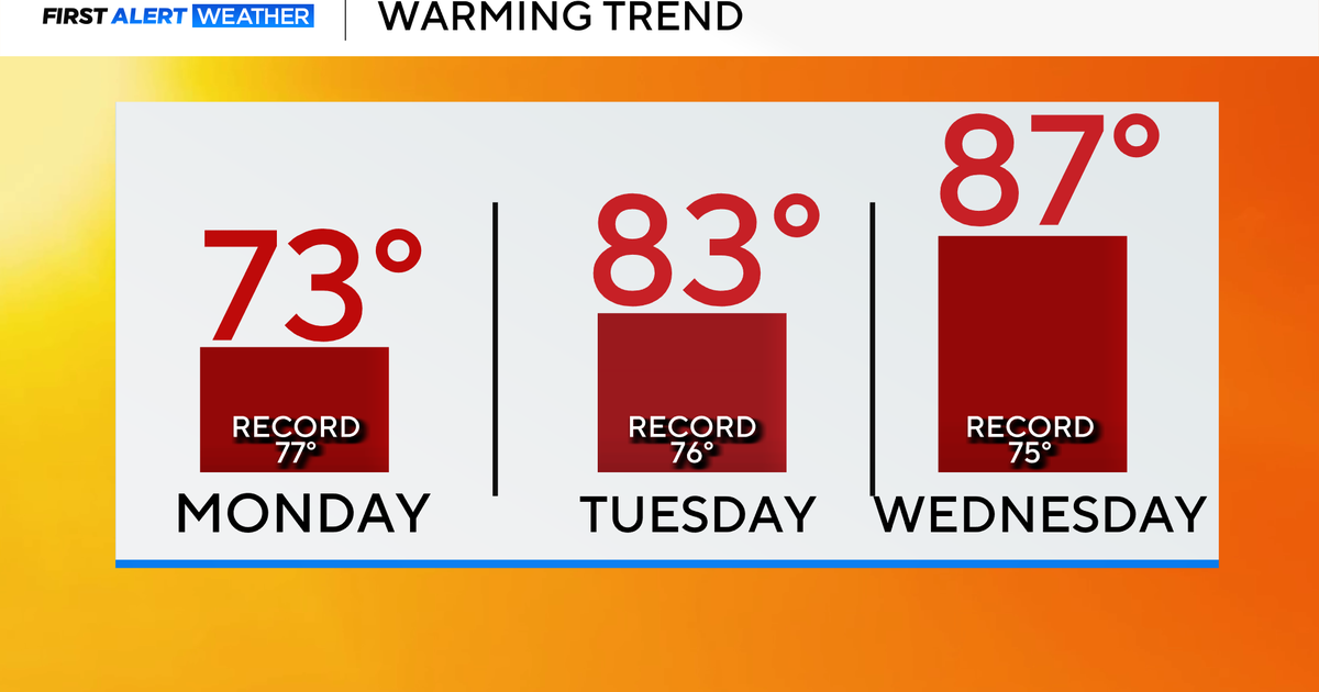
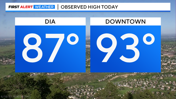
Summer warmth has finally showed up and with one little road block on Thursday the heat should stick around for awhile. Denver had it's warmest day this year so far with a high of 87 degrees! Downtown the temp zoomed into the low 90s!
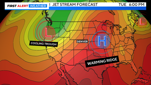
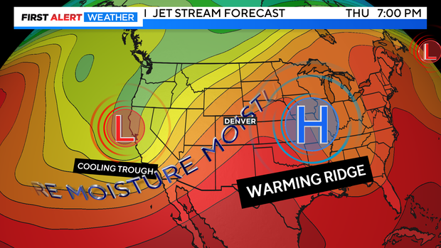
On the big jet stream map we are watching a warming ridge of high pressure that is bringing in the first of the summer warmth for Colorado. This should stay intact most of the week.
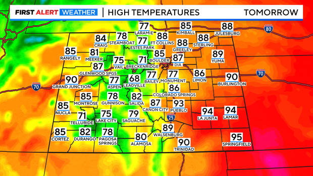
With southwesterly winds the state will be partly cloudy and dry on Tuesday with highs warming into the 80s and 90s over the eastern plains. Temperatures in the mountains will be in the 70s to low 80s with 90s and 80s on the Western Slope.
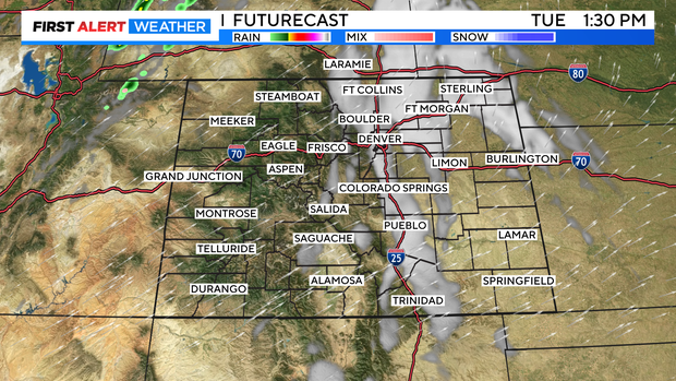
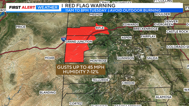
With the heat, wind and dry pattern in the west we have the first Red Flag Warning of the month for the Grand Valley into the Rifle area for Tuesday from 11am to 8pm. Winds may gust up to 45 mph and relative humidity levels may drop down to 7 to 12 percent.
There is a cool trough of low pressure on the west coast. As this drops south it will help to send more moisture and a weak cold front up into Colorado Wednesday night into Thursday. This will cool temperatures and increase moisture available for showers and thunderstorms to develop.
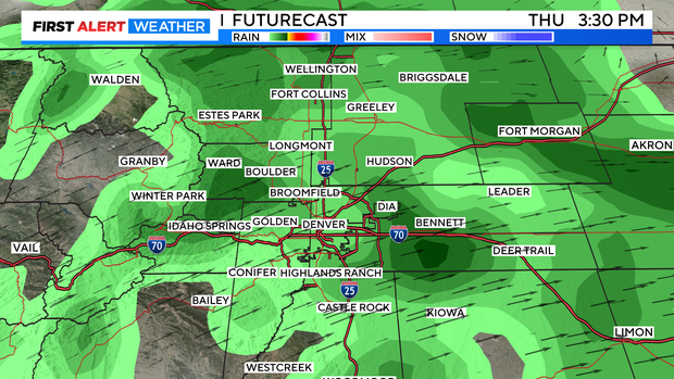
The best chance for rain this week will be on Thursday as it will be a cloudy and cooler day as well.
The change will be short-lived however, as warmer drier weather moves back into play by the weekend.