Colorado rivers could rise higher than last week as another major flooding threat develops

Just one week after devastating flooding across southwest Colorado, another powerful storm is moving in. Unfortunately, rivers are expected to rise even higher this time.
The San Juan River in Pagosa Springs reached around 15 feet last week. Current data indicates a crest near 17 feet by early Monday. The record is 17.8 feet, set back in 1911, just to give you an idea of the significance of this forecast.
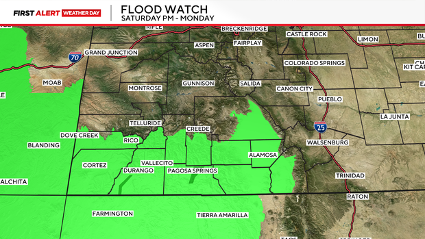
A flood watch has been posted for late Saturday night through Monday morning.
Mandatory evacuations underway
Mandatory evacuations are in effect for flood-prone areas of Pagosa Springs and along the San Juan, Piedra, Rio Blanco and Navajo rivers.
San Juan and Hermosa streets will close to through traffic beginning at 6 a.m. Sunday. Additional road closures, including portions of Highway 160, may be necessary.
Why is this storm so concerning?
Another atmospheric river, which is essentially a highway of moisture coming in from the Pacific, is the fuel for this storm. Parts of the San Juan Mountains could pick up another 2 to 5 inches of precipitation.
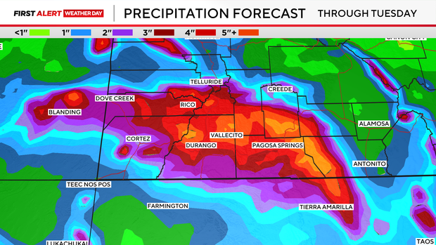
Snow levels could climb to between 11,000 and 12,000 feet Sunday. So, most of the moisture that falls during the day will be rain, not snow. The ground is already saturated, it simply cannot absorb this new rainfall.
And it's not just Pagosa Springs expected to be impacted. The Conejos River near Mogote and the Rio Grande near Del Norte are also facing major flooding concerns.
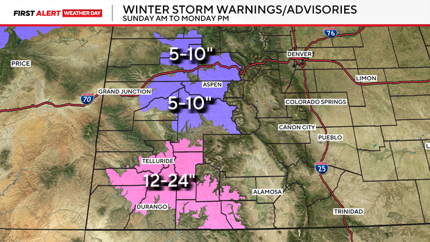
As colder air arrives Sunday night into Monday, some of that rain will change to snow, with 12 to 18 inches possible above 10,000 feet in parts of the San Juans.


