Cold front advancing towards Colorado has slowed, not set to arrive in the Denver area until late afternoon

An advancing cold front has slowed, and is not set to arrive in the area until the late afternoon Wednesday. Its late arrival will allow temperatures to climb well above average again Wednesday afternoon. Highs in the Denver metro and Front Range are expected to reach the low to mid-60s again.
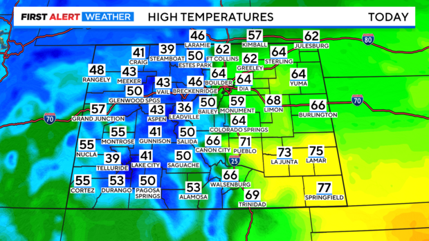
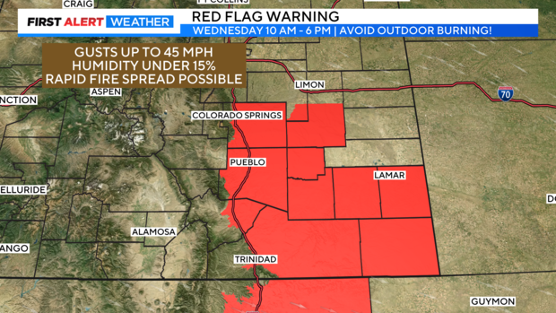
Temperatures in the southeastern corner of the state will climb into the low to mid-70s. The warmth, combined with strong winds, and low humidity are contributing to increased fire danger. A Red Flag Warning is in effect through 6 PM Wednesday.
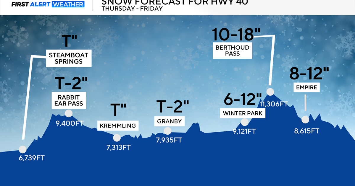
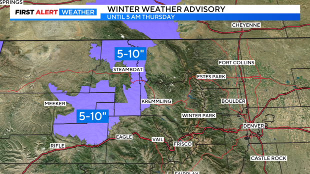
While the southeast deals with fire danger, Colorado's high country will see snowfall Wednesday through Thursday, with most of the accumulating snow expected north of Interstate 70. Winter Weather Advisories are in place for the Park Range, Medicine Bow Mountains, and the Gore Range through Thursday morning.
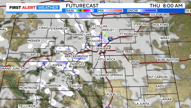
Most of this moisture will track north of Colorado throughout Wednesday afternoon, but by the evening hours, it starts to trickle south, bringing rain changes to the Front Range.
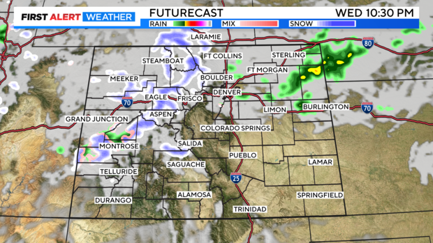
Those isolated rain showers will transition into a rain/snow mix in the overnight hours, but accumulations for the Denver metro area and Front Range are minimal, with a trace to 1" possible in most areas. The Palmer Divide and Foothills could pick up around 2" of snow.
By Thursday afternoon chances for rain and snow begin to diminish as a ridge of high pressure builds again. By the weekend temperatures will rebound back into the 60s.