Active weather to bring severe storm threats to Colorado

It will be another warmer-than-normal day across the state Wednesday afternoon, but the active weather will bring a risk of severe weather for Eastern Colorado later in the day.
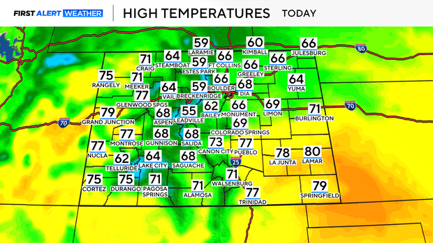
High temperatures will climb into the mid to upper 60s for the Denver metro area this afternoon, with the upper 70s possible out east today.
Most of the day will be quiet and sunny, but the cloud cover will begin to build later this afternoon.
Wednesday afternoon, isolated showers and widely scattered storms developed. Some of these storms have the potential to strengthen as they fire up and travel out into the plains.
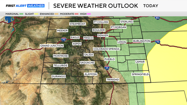
Most of eastern Colorado, east of the Denver metro area, is under a Level 1 – Slight risk for severe weather Wednesday afternoon.
The greatest threats on Wednesday include damaging winds and large hail.
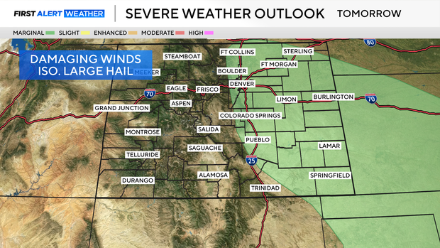
By Thursday, the risk migrates West, including the Denver metro area and Northern Colorado.
There are similar threats on Thursday, with wind and hail having the greatest potential impact.
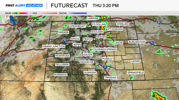
There is a slightly higher chance that more neighborhoods will see rain going into the day on Thursday.
These showers and storms will develop in the mid to late afternoon, with some potential development of severe weather on Thursday.
While each day this week comes with a chance of showers and storms, no day is expected to be a washout. That said, have your weather apps handy to keep an eye on radar and track weather alerts in your neighborhood.