Accumulating snow in Denver, significant impacts across Colorado's high country

Accumulating snow will continue across Denver and Colorado's high country through the day Friday. Temperatures in the days leading up to the storm have been marginal, making it harder for snow to accumulate on the roads.
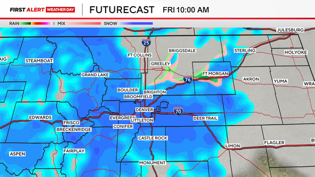
The heaviest snow bands are expected through about 1 p.m. across the Front Range, meaning roads may toggle between wet and snow-covered several times through the afternoon.
Snow rates will approach 1" an hour.
Winter weather advisories remain in effect for the Denver metro area, Boulder and the Palmer Divide, while winter storm warnings continue along the Continental Divide, including parts of western Boulder County and Jefferson County.
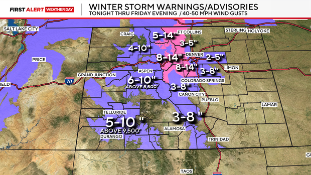
Snowfall rates up to 1 inch per hour could allow for quick accumulations on roads and grassy surfaces. Winds may also gust to 40 mph, leading to blowing snow and reduced visibility.
Temperatures will hover near the freezing mark Friday, making this a classic spring slop type of event.
Snow will gradually come to an end between 3 p.m. and 8 p.m., from northwest Colorado toward the southeast, with most meaningful accumulations wrapping up by the afternoon.