There's bad news and good news for parts of Colorado with this week's drought update

Colorado's weekly Drought Monitor update is out and there is some bad news and a small bit of good news. The bad news is that even with the frequent showers and thunderstorms that parts of the state have picked up over the last week and a half, the mountains of our state have not seen enough to make a dramatic change. As a result, many of those areas have remained in extreme to exceptional drought. In a few of the high country spots exceptional drought has only decreased about .5 to 1 percent of a percentage point.
The areas that have had significant rainfall from this month's monsoon storms have seen a slight downtick in the drought levels -- for example, parts of southwest and northwest Colorado have seen many areas drop from extreme to severe. Not great, but heading in the right direction.
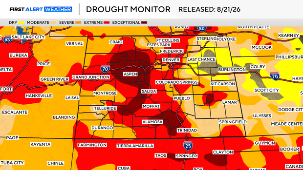
The good news is for areas near Denver and the northeastern plains. In fact, areas from Sterling down to Deer Trail and Limon out to the Kansas state line have dropped down to dry or no drought at all. This is all due to showers and thunderstorms that have soaked those areas over the last two weeks.
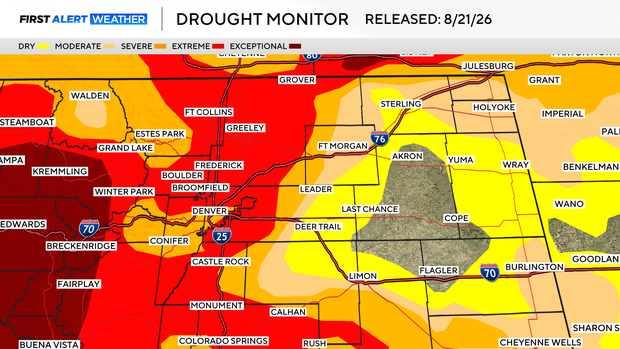
Across Denver and the Front Range the exceptional drought areas have been washed away. That being said, much of the areas of the foothills from Castle Rock through Aurora and up to Fort Collins remain in the extreme category while, a nice chunk of real estate from north Denver across Golden into Georgetown and down into central Jefferson County has dropped down to severe which would be 3 out of 5 on the severity scale.
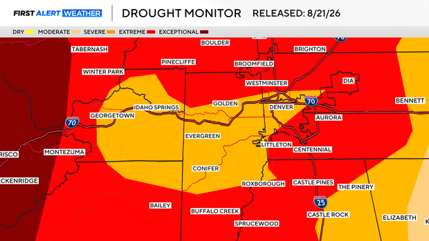
So overall, Colorado still has a long way to go before we get out of the drought, with close to half of our home state still in the top two categories of drought (extreme and exceptional).


