Flooding concerns across Colorado as widespread rain expected through Thursday

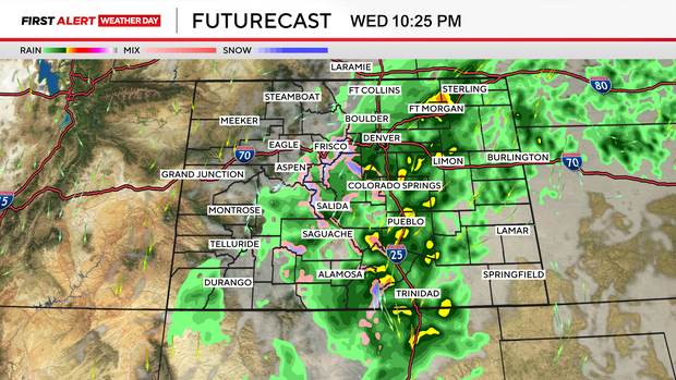
A very wet stretch of weather is setting up across Colorado, with widespread rain expected through Thursday and the potential for some areas to pick up several inches, raising flooding concerns.
The heaviest rain is expected to develop late Tuesday night and continue into early Thursday, with the greatest concern focused on the Palmer Divide, southern Front Range foothills, and southern and southeastern Colorado.
A Flood Watch is in effect for those areas from late Tuesday night through Thursday morning.
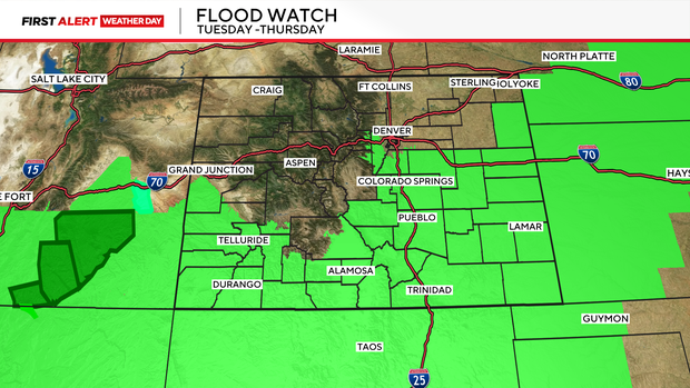
Right now, areas inside the watch could see around 1.5 to 3 inches of rain, with a few spots potentially seeing 4+ inches.
Parts of southern Colorado are under a "moderate" risk for excessive rain and flash flooding the next two days.
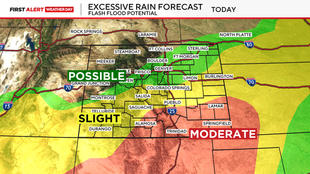
One of the biggest questions will be how far north the heaviest rain will extend.
The Denver metro is sitting near that cutoff, which means rain totals across the metro are still one of the bigger question marks.
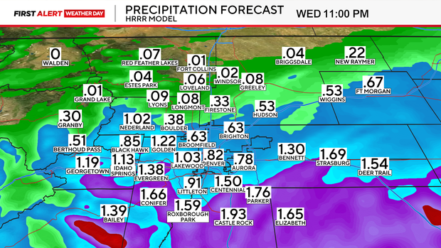
At this point, Denver's totals could range from .50" to 2.5", with the south metro expected to see the most, but a small shift in the storm track could make a big difference in where those higher totals end up.
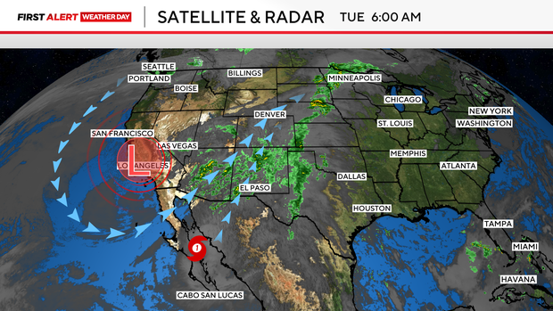
An upper-level trough moving through the Southwest will work with moisture from the remnants of Hurricane Polo, bringing no shortage of moisture. That unusually moist air will help keep rain chances elevated through the middle of the week.
A developing area of low pressure is expected to form over New Mexico and then move east or northeast.
If that low tracks into southeastern Colorado, that could bring more widespread rain and potentially higher totals along the Palmer Divide and southern foothills.
If the low tracks farther east, the highest rain totals would likely stay farther south and east.
A weak cold front will also move through Tuesday, bringing cooler temperatures into the mid to upper 60s, more cloud cover, and northerly winds.
With the push of some colder air, some snow is also possible in the highest elevations early Thursday.
Snow levels should stay above 10,000 feet, with lower accumulations expected.
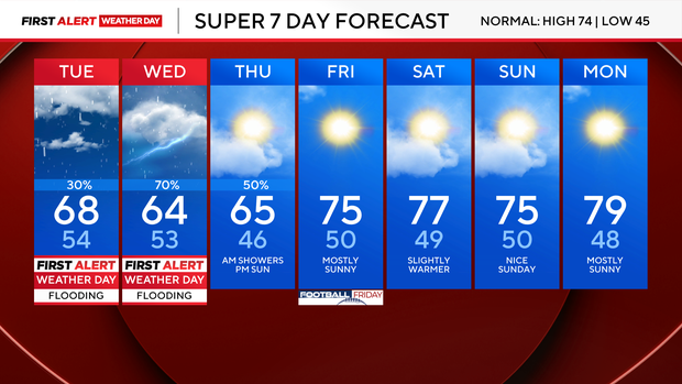
Rain chances will finally start to come down Thursday as the system moves east.
Behind it, Colorado should trend warmer and drier heading into the weekend.


