Colorado Weather: 2020 Starts With Fresh Snow In The Mountains
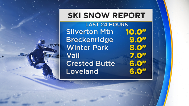
DENVER (CBS4) - Skiers and snowboarders are rejoicing at more than a half foot of snow for virtually every ski area in the state. And some mountains will get more than a foot before the snow starts tapering off Thursday afternoon.
The first storm of the year hit just a few hours into 2020 with snow starting to fall early Wednesday morning. By Thursday morning most ski areas were reporting 5 to 10 inches of fresh powder.
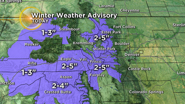
In terms of additional snow, a Winter Weather Advisory continues until 12 p.m. on Thursday for most mountain areas east of Vail Pass. These areas should get 2 to 5 inches of additional snow. Similar amounts are expected west of Vail Pass with the advisory continuing until 12 a.m. Friday.
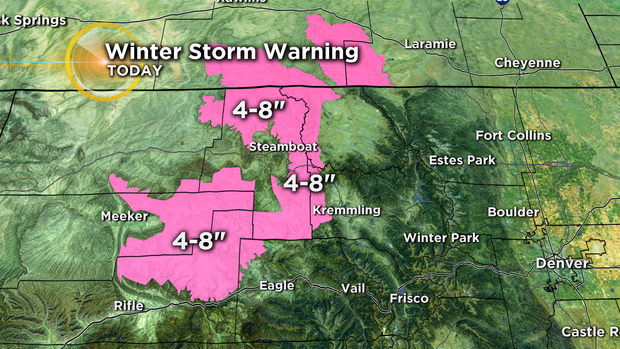
Meanwhile, for the Rabbit Ears Pass area and Mount Warner at Steamboat Ski Resort, additional accumulation will be higher with 4-8 inches of additional snow expected by Thursday night. These areas along with the Flat Tops region is under a Winter Storm Warning until at least noon on Thursday.
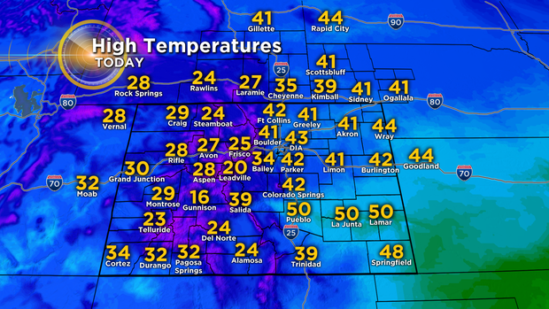
All the snow will stop short of the Denver metro area where skies will stay partly cloudy through the day on Thursday. There will be far less wind compared to Wednesday but temperatures will be noticeably cooler with highs in the lower 40s which is close to normal for January 2.
Warmer weather will arrive just in time for the first weekend of the year with highs in the upper 50s to near 60 degrees on Saturday.