Chicago Weather: Snow Turning To Rain For Friday Morning Commute
This wintry system will persist for about 48 more hours before we're done with it for good.
Watch CBS News
This wintry system will persist for about 48 more hours before we're done with it for good.
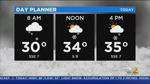
Snow and a wintry mix are expected to continue throughout the day.
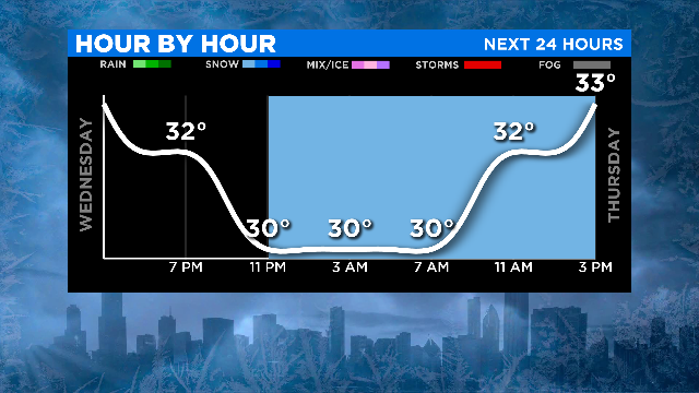
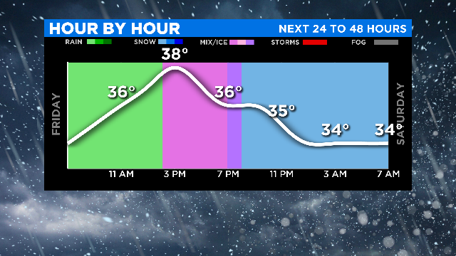
A weak system will be with us for a few days, bringing light precipitation in the form of snow, then a rain-snow mix, then rain, and then snow once more.
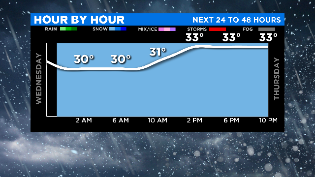
A wintry mix is approaching and could impact your Thursday morning commute.
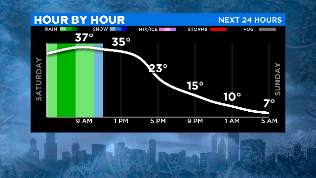
On Friday evening, the area was clobbered with fast-falling snow and strong winds. The snow ultimately amounted only to a few inches – and on Saturday, it got rained on.
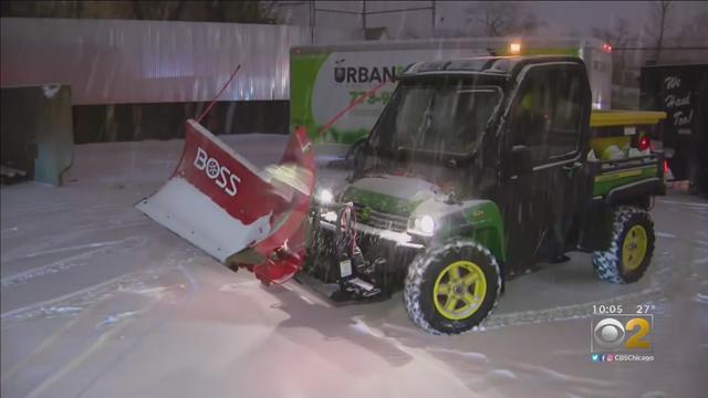
Many a citizen has enjoyed the limited snow storms, but don't put Jimmie Williams in that category.
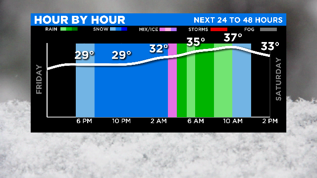
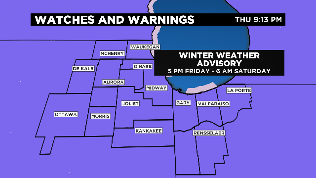
A Winter Weather Advisory will be in effect Friday afternoon through Saturday at 6 p.m.
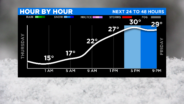
Following a cold night on Thursday night and increasing clouds Friday morning, snow will begin falling in the area Friday evening.
Pockets of fog still lingered across the area Wednesday afternoon. When the Arctic front crosses the area Wednesday evening, the front clears visibility as fog dissipates.

The worst of the snow associated with the weekend winter storm was coming Saturday night.
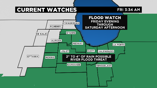
Chicago areas will be under a flood watch by 10 p.m. Friday when heavy rain is expected to begin.
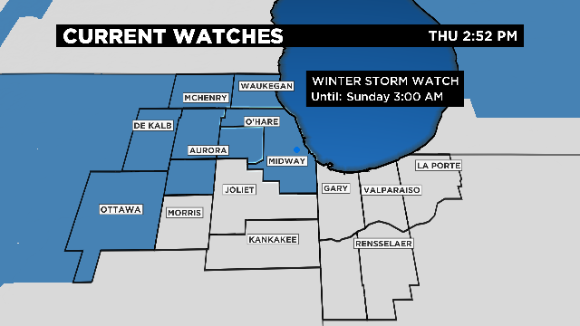
A winter storm watch will go into effect beginning Friday night – as the Chicago area deals first with heavy rain and then a weekend of snow.
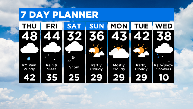
For Friday, temperatures will lower a bit and rain could be heavy in areas to the southeast of Chicago going into Friday evening.
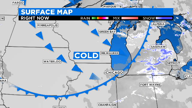
We could see some rain, then a snow shower associated with the passage of the cold front late Tuesday afternoon and evening.
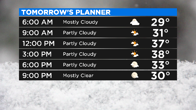
High pressure was sliding over northern Illinois Monday afternoon, bringing us sunny and pleasant conditions.
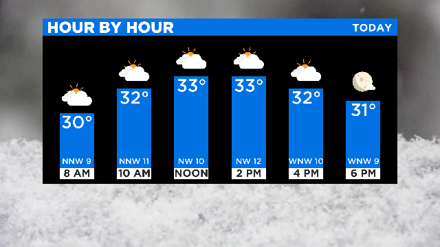
A quick burst of snow has cleared out of the area and Chicago can expect a bit of sun later on Saturday.
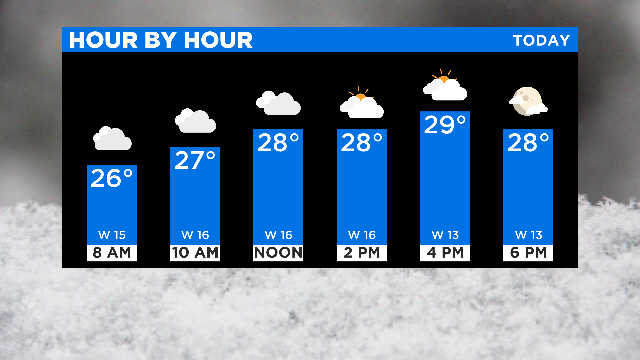
CBS 2 meteorologist Ed Curran is warning commuters to be aware of slick driving conditions with snow on the roads and high winds.
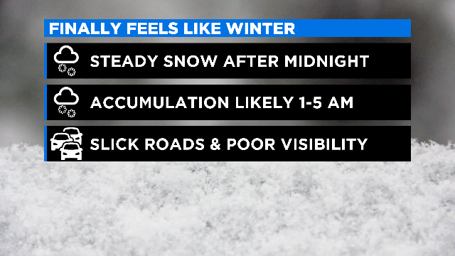
Gusty winds and a few snow showers are possible through sunset Monday night.
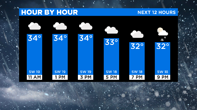
Snow is possible overnight in the Chicago area.
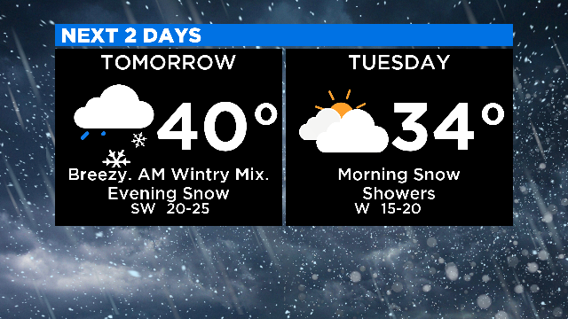
A dynamic system will wrap up on Sunday night through Monday and Tuesday – bringing rain, wintry mix, gusty winds and a chance of snow.

A storm system will pass south of the Chicago area Monday night, keeping any accumulation of snow at bay.
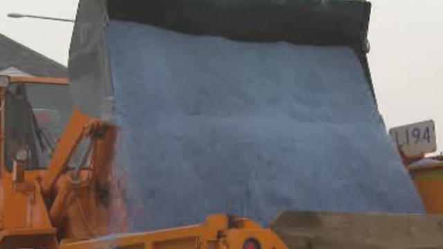
While only light snow is expected for the Chicago area Sunday night into Monday morning, the Illinois Department of Transportation had a warning for drivers in downstate counties – where several inches could fall.
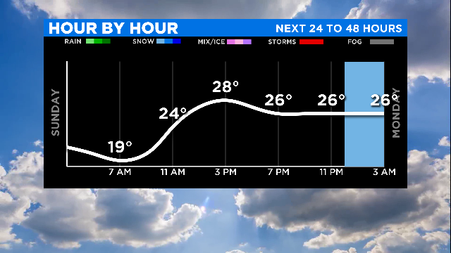
Temperatures started out in the teens early Sunday, and will climb only to around 30 by the afternoon.

An Arctic front is targeting Chicago Monday evening, but an anticipated band of snow for the west of the city looks like it will not be materializing after all.
There is a dense fog advisory in effect Wednesday morning.