Lingering snow and flurries overnight; more snow chances Saturday and Sunday

CHICAGO (CBS) -- After a snowy Friday evening, some lingering light snow and flurries will continue overnight in the Chicago area.
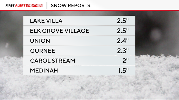
Initial snowfall amounts of as much of 2.5 inches are being reported from Friday night's snowfall.
Lows tonight will be in the mid 20s, then rise to the low 30s by Saturday morning.
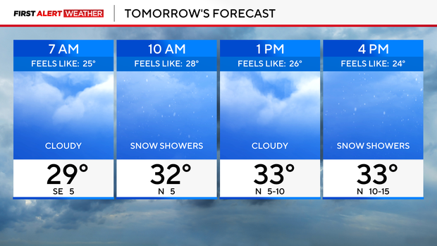
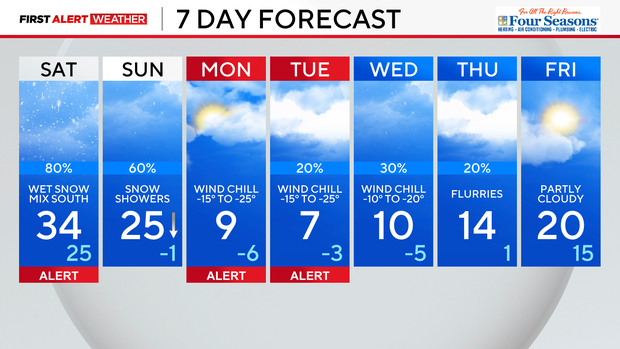
Additional snow chances are likely on Saturday. With highs slightly above freezing, wet snow is likely, with a freezing drizzle threat for some areas south of I-80.
Snow showers off of Lake Michigan are in the forecast for Sunday. An additional 1 to 3 inches of snowfall is possible through Sunday afternoon.
Our attention then turns to dangerously cold temperatures for early next week. An Arctic airmass will move in on Sunday, forcing lows below zero Sunday night. Wind chills by Monday morning could be as cold as -25°, with highs on Monday only in the single digits.
Tuesday morning could be even colder, with wind chills in the morning as cold as -30°. Temperatures will be slow to rise next week, with teens for highs mid-week and 20s by next Friday.
Forecast at a glance
TONIGHT: Snow, winding down after 10 p.m. Gusty winds. Low: 26.
TOMORROW: Cloudy with occasional wet snow, mixing with sleet and rain south of Chicago. High: 34.
SUNDAY: Snow showers. Colder winds. High: 25.


