Snowfall In Massachusetts This Weekend Could Follow Record Warmth
BOSTON (CBS) -- 60 degrees one day, snow the next? That sounds about right!
December thus far has been a dud for snow lovers.
Ski areas are struggling to open or stay open, and backyard rinks look more like swimming pools.
By the end of this week, temperatures will be averaging more than five degrees above the average per day, likely making the month a top ten warmest on record to date.

Dreams of a White Christmas are fading, but don't give up hope!
Colder weather is on the way, and we will likely have several chances at snow before Santa makes his trek south. And it starts this weekend!
Before we get there, we have one more significant warmup.
Temperatures on both Thursday and Friday will likely hit or surpass 60 degrees in parts of southern New England. Record-high temperatures are certainly possible on either day (Boston's current records: 64 degrees on both days).
We have already hit 60 in Boston four times this month, and 10 times since the start of November, but this COULD be the last time we see 60 for a while, likely until sometime next year.
We are pretty confident that a colder, more "typical" December stretch is likely for the last couple weeks of 2021. But snowfall is a bit less certain.

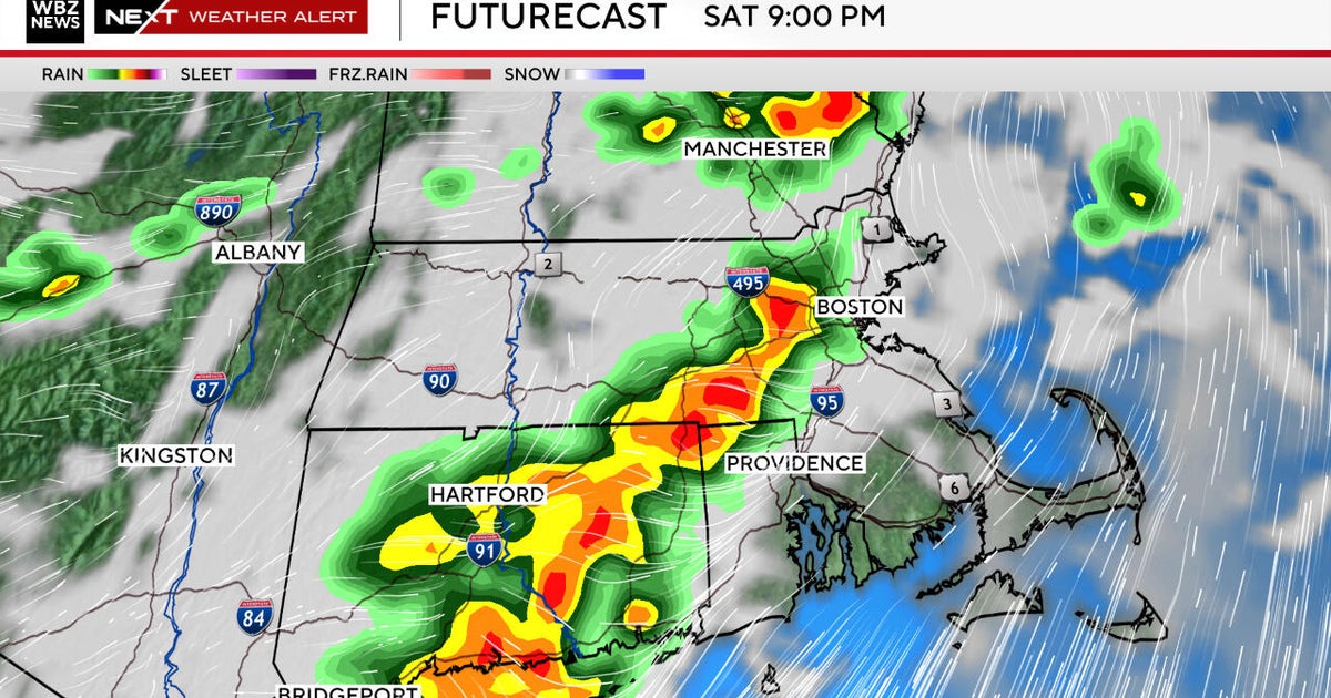
While some storms may be shunted completely south of New England, others may take a more classic "La Nina" track, splitting our area with a mix of rain and snow, kind of like what we expect this weekend.
While it is still several days away, we feel fairly confident in some aspects of the potential weekend storm:
- It will be a fairly quick mover
- It will be a weak system, no wind or coastal concerns
- Temperatures will be marginal, meaning the likelihood of a rain/snow line somewhere in our area
- Given the above, the highest risk of accumulating snow will north and west of Boston
If you are planning on traveling or perhaps doing some holiday shopping this weekend, the most likely time for highest impact would be late Saturday afternoon through very early Sunday. Again, we will refine the timing as we get closer, but for now, plan out the best travel times being the first half of Saturday and second half of Sunday.
Way too early to talk snowfall amounts, but figure something on the scale of 1-3" or 3-6" in areas northwest of Boston (how far northwest remains to be seen).
Closer to the city and to the south and east there is a greater likelihood of mixed precipitation or rain. Should the precipitation shield reach as far north as the Mountains, it would certainly be snow up there, and they sure can use it!
We will continue to monitor and update the forecast the rest of this week. Stay tuned to WBZ-TV, CBSBoston.com and CBSN Boston for all the details.
Follow Terry on Twitter @TerryWBZ