Tornado warnings, watch expire in Massachusetts
A tornado warning was issued for parts of Massachusetts on Thursday as strong storms moved across the state. The warnings were in effect for parts of Worcester, Middlesex, Hampshire and Hampden counties.
The warning was issued shortly before 5:30 p.m. and was canceled at about 6 p.m. The tornado warning was issued due to radar indicated rotation, and no tornadoes have been confirmed.
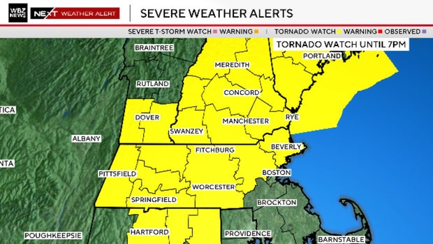
A severe thunderstorm warning was also in effect for parts of Worcester, Norfolk and Middlesex counties until 7:00 p.m.
A tornado watch was issued for parts of Massachusetts earlier on Thursday afternoon. The WBZ Weather team issued a NEXT Weather Alert for the chance of severe thunderstorms in the Boston forecast Thursday afternoon and evening.
The tornado watch included Essex, Middlesex, Worcester, Hampden, Hampshire and Franklin counties in Massachusetts until 7 p.m. There was also a tornado watch for New Hampshire and southern Maine until 7 p.m.
Tornado risk for Boston
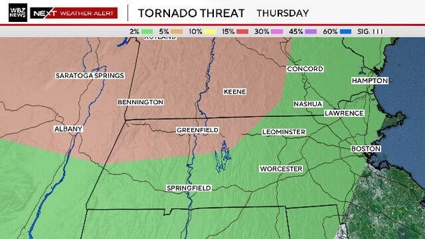
The Storms Prediction Center had placed areas north and west of Boston and I-95 in a "2% tornado risk" on Thursday.
On the map below, the brown area which extends from southwestern New Hampshire through Vermont and the Berkshires is a "5% tornado risk."
This means that at any given point in the green or brown zones, there is either a 2% or 5% chance of a tornado forming within a 25-mile radius.
This may seem quite low, and it is, but we only receive a handful of days each year with this type of risk.
Let's be clear, this is not a day when all the atmospheric parameters are lining up perfectly for severe weather in southern New England. However, there is a decent amount of vertical wind shear present Thursday. Therefore, if any storms are able to form, they could quickly reach severe levels and perhaps even rotate.
The period of greatest risk in central and eastern Massachusetts would be from about 3 p.m. to 9 p.m. and mostly north and west of Boston, especially across New Hampshire, Vermont and Maine.
In additional to the small tornado risk, there is also a chance of damaging, straight-line winds, lightning and torrential downpours.
We will keep you updated all afternoon on WBZ-TV, CBS News Boston and on WBZ.com.


