Snow, Sleet, Rain For Tuesday Morning Commute
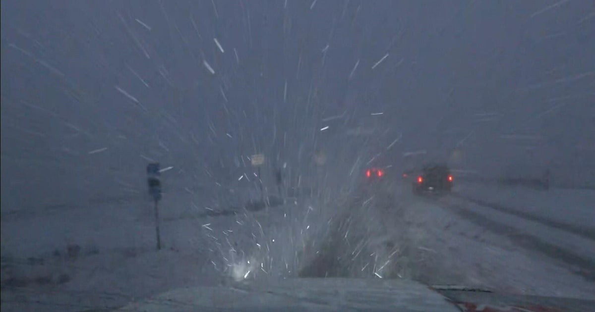
BOSTON (CBS) - Just like that, we've flipped the switch to winter. Monday's temperatures won't get out of the 30's and with an active wind gusting occasionally over 20 mph out of the north, our "real feel" wind chill values will be in the 20's. Meanwhile, a significant storm is bringing a range of weather impacts to the country right now – from heavy snow and blizzard conditions to severe weather and flooding.
This will not be a major winter storm for us here in southern New England. But, it is the first wintry event of the season – and timing is everything. So let's break down the details.
TIMING:
Pockets of snow arrive around or just after midnight, light to moderate for most. Areas of snow will continue into the Tuesday morning commute, changing over to sleet and freezing rain then plain rain. The transition should occur from south to north during the mid to late morning as "warmer" air in the mid-levels of our atmosphere moves in.

For those along the south coast, this transition happens pretty quickly. Interior cities and towns will take longer to make the changeover, meaning slippery travel is likely to continue until the early afternoon in areas like southwest New Hampshire and the Route 2 corridor.

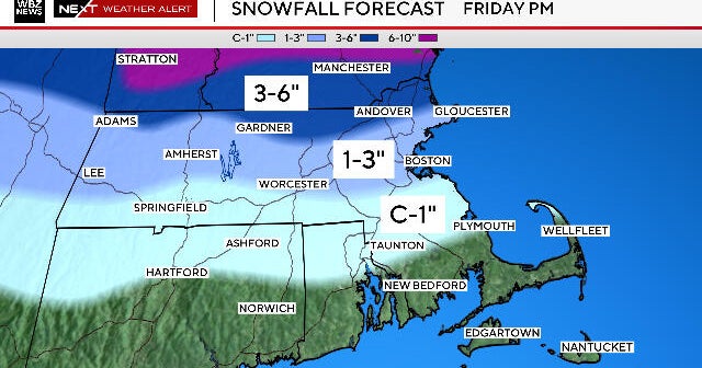
AMOUNTS:
Nothing too impressive…a sloppy coating to one inch is likely in the city of Boston, with higher amounts 2-to-4 inches along and outside of I-495. The jackpot areas will be right where we want it – northern New England. Ski country will be psyched as it has been a rough start to the season to say the least. In fact, over a foot of snow is possible in parts of northwest Maine.

ICING CONCERNS:
Perhaps my biggest concern is for pockets of isolated outages that could result from a period of icing across the interior of Massachusetts Tuesday morning to midday. All it takes is a trace of ice to create treacherous travel.
Expect a general trace to 0.1 of an inch of accretion in the areas shaded in pink below, perhaps as much as 0.25 of an inch.

Looking ahead to New Year's Eve, our weather should stay pretty quiet. It won't be bitterly cold, but temperatures will dip into the upper 20's and low 30's, so you'll want to be bundled up for the ball drop. Plenty of cold hangs around for the first week of January – but it appears as though no big storms are in the cards.
Tune in to our team coverage Tuesday morning starting at 4:30 a.m.
-Danielle
Watch: Latest Forecast