Snow continues overnight in Massachusetts, poor travel expected into Monday morning
The WBZ Weather team is continuing a NEXT Weather Alert for a widespread, plowable snow storm Sunday night into early Monday.
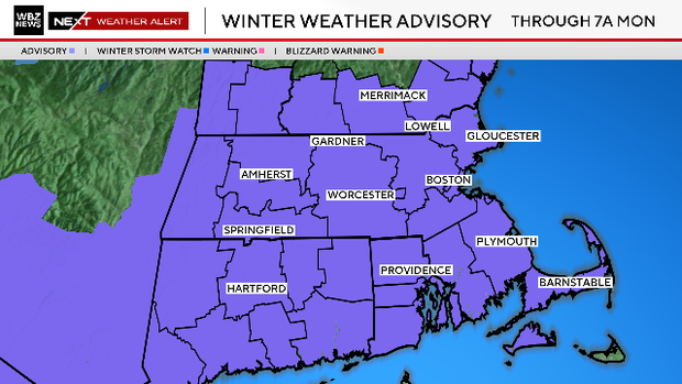
A Winter Weather Advisory is in effect through 7 am Monday for all of southern New England (except for Nantucket).
Massachusetts snow timeline
While snow showers through the daytime hours were light, bringing minimal impact, the snow will become steadier and heavier through the evening until around 1 a.m.
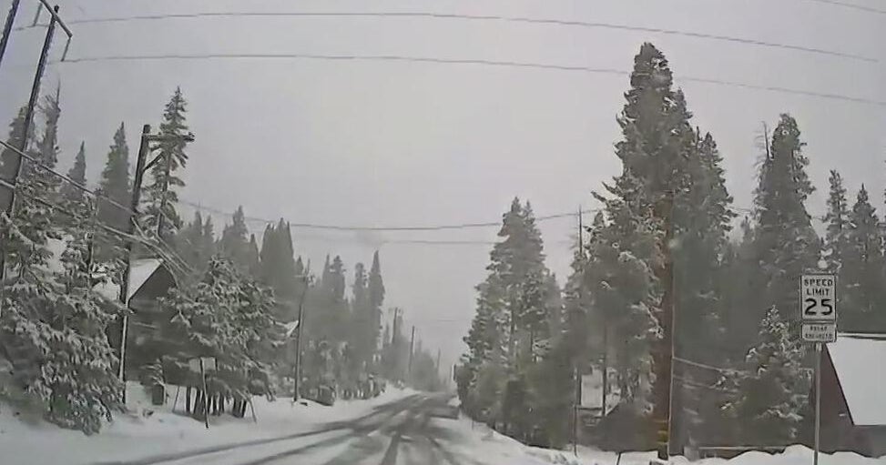
As temperatures drop to around and below freezing the snow will also be able to accumulate leading to snow covered roads and slick travel.
7 p.m.-Midnight: This is the brunt of the storm and when the majority of the accumulation will occur. Snow will expand in coverage to include most of central and eastern Massachusetts. Roads will become snow-covered and visibility will be lowered in many areas.
Midnight-6 a.m.: The main area of snow exits off the coast, and we are left with a much lighter and scattered snowfall. There may be one final burst along the immediate Coastline before tapering.
6 a.m.-10 a.m.: Chance for some last scattered snow showers snow showers during Monday morning. They will be lighter than at night, but could bring an extra light coating to some roads.
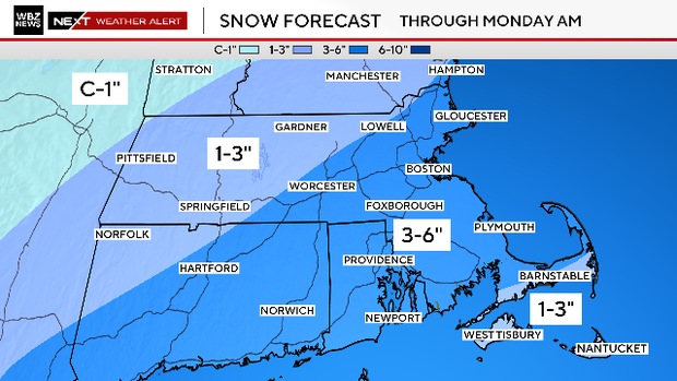
How much snow will Massachusetts get?
3-6 inches: Just about all of eastern Massachusetts including Worcester and Boston and all areas around and inside of Interstate 495.
1-3 inches: Areas north and west of I-495 and Route 2, including western Massachusetts, southern New Hampshire, southern Vermont, and southern Maine.
1-3 inches: Most of Cape Cod, the Islands and the Massachusetts South Coast, due to mixing with rain.
Wet, heavy snow
Temperatures throughout the storm will be near or slightly above 32 degrees. This will make for a very wet and pasty snowfall. This kind of snow is also a bit harder to readily accumulate at first due to some melting with contact.
Keep in mind, when you eventually head out to shovel, this stuff is going to be heavy to move around. Take is slow and easy.
What's next?
We'll get some melting with temperatures in the low to mid 30s Monday but after that … it's going to get cold! An Arctic front moves through Monday night into Tuesday bringing highs just in the 20s Tuesday and wind chills in the single digits and low teens. Another batch of cold air then looks to move in for the end of the week and weekend!