Weather timeline shows when snow is forecast to start and end in Boston and Massachusetts this weekend
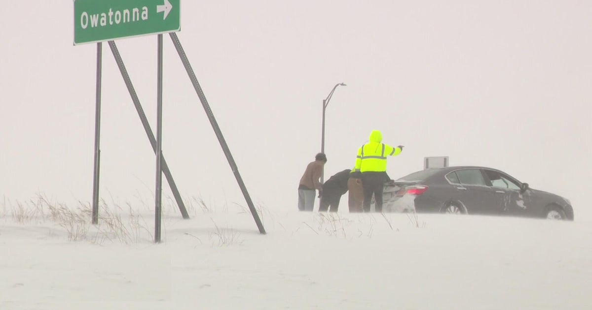
This weekend's snowstorm in Massachusetts is going to be a long-duration event. The weather forecast calls for up to 20 inches of snow to fall with varying degrees of intensity for about 36 hours in the Boston area.
So, when does it start? When does it end? When should you clean up? Here's the latest on the storm timeline.
When is the snow starting in Boston?
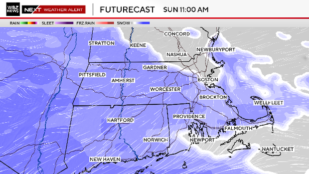
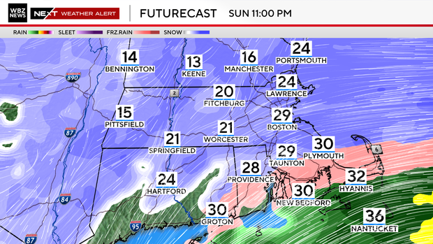
Sunday 8 a.m. to noon: There may be some stray flurries early Sunday morning here and there but the true shield of snow associated directly with the storm will move in from south to north across southern New England between 8 a.m. and 2 p.m.
The first flakes should fall in Boston and Worcester sometime between 10 a.m. and 12 p.m. Along the Massachusetts/New Hampshire border, it'll be between noon and 2 p.m.
Intensity: Light to moderate during the morning hours.
Accumulation: Very little accumulation expected, scattered coatings.
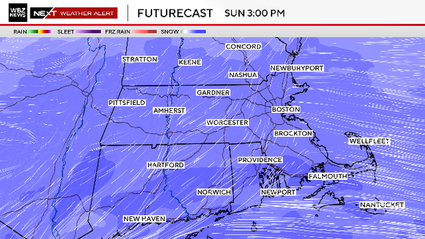
Sunday noon to 3 p.m.: The snow encompasses all of southern New England during this timeframe.
Intensity: Light at first, then the intensity picks up quickly
Accumulation: Mostly coatings to an inch or so. Up to 2" well southwest.
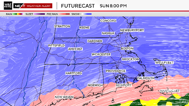
Sunday 3 p.m. to 8 p.m.: We enter the "teeth" of the storm. Visibility lowers significantly, and the snow really starts to stack up. Travel gets worse by the hour. We may see some mixing with ice/rain over the Islands.
Intensity: Moderate to heavy. Some areas receive 1" or more per hour.
Accumulation: Widespread 3-6"+ by 8 p.m.
When is the worst of the storm in Boston?
Sunday 8 p.m. to midnight: The storm is at its peak, travel at its worst. Visibility less than a quarter mile in heavier bands. Winds gusty along the coastline.
Rain/ice mix in along the South Coast, Cape and Islands. A coastal front sets up near I-95 and temperatures rise in eastern-most areas, making the snow a bit wetter.
Intensity: Heavy, potential for 1-2"+ per hour.
Accumulation: 6-12" across southern New England.
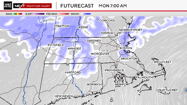
Monday 12 a.m. to 7 a.m.: Steady/heavy snow starts to become more scattered. A dry slot moves up over portions of Connecticut, Rhode Island and southeastern Mass. This will either shut off the precipitation completely or dramatically lessen the intensity.
The rain/mix line reaches its farthest northern location (likely around Plymouth). Winds will be gusty out of the northeast along the coastline. The coastal front sits to the west of Boston along I-95, marking the difference in temperatures between the upper 20s to the east and teens to the west.
Intensity: Starts heavy then becomes quite variable/spotty.
Accumulation: 10-16" in all areas except South Coast/Cape/Islands.
When does the snow end in Boston on Monday?
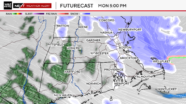
Monday 7 a.m. to 5 p.m.: The storm makes its closest pass to southern New England and then begins to head east, out to sea. The winds will veer to the north, and the coastal front will be swept away. The frigid, Arctic air will extend back over eastern and southeastern Mass., and any standing water from the rain/mix area will freeze quickly.
Areas of snow now rotate from north to south but are scattered. It will snow moderately in some areas, lightly or not at all in others. Watch for some locally heavy, ocean-enhanced bands of snow near the coastline.
Intensity: Variable.
Accumulation: 12-20" by the end of the day, again except for extreme southeastern Mass. It would make sense to do a driveway cleanup during the day on Monday, just keep in mind you could receive another coating to 2".
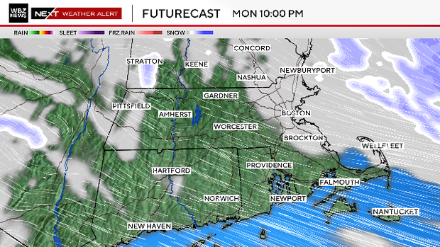
Monday 5 p.m. to midnight: The area of snow begins to rotate eastward. Snow ends in central and western Mass. The final few snow bands pass through eastern Mass.
You can safely go out and cleanup the driveway without worrying about much additional accumulation.
Tuesday 12 a.m. to 7 a.m.: Done. Let the cleanup begin. Temperatures will be very cold Tuesday and all of next week, we probably will stay below 32 degrees right through next weekend.
In other words, no melting.